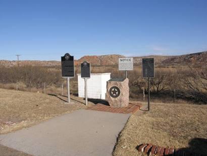
Second Adobe Walls Battle Site
USA /
Texas /
Stinnett /
County Road 23
World
/ USA
/ Texas
/ Stinnett
World / United States / Texas
battlefield, NRHP - National Register of Historic Places, ghost town, historic landmark
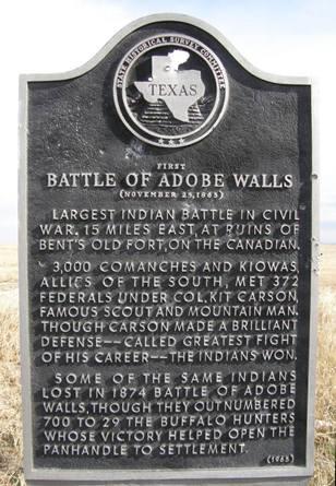
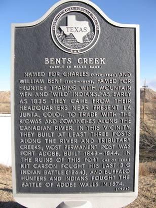
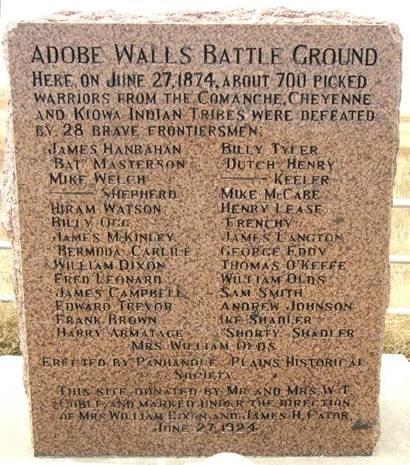
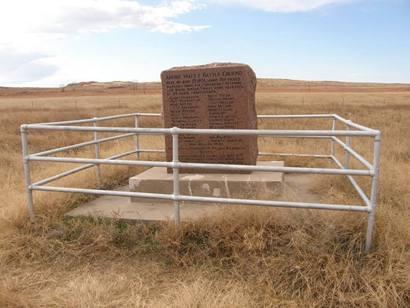
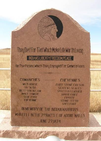
Adobe Walls was established in 1843 as a trading post for buffalo hunters and later became a ranching community. In the November of 1864 First Battle of Adobe Walls, native Americans successfully repelled attacking troops led by Kit Carson. Ten years later, on June 27, 1874, known as the Second Battle of Adobe Walls, civilians at the Adobe Walls trading post successfully repelled an attack by native Americans. The second battle led to a military campaign which resulted in the relocation of native Americans to Indian Territory in Oklahoma.
Adobe Walls was never a large community. It was mostly populated with ranchers, their families, and ranch employees. The post office closed in 1921, and the population from 1940 to 1970 was listed in the Texas Almanac as 15 people.
This six-acre tract contains the remains of the 1874 trading post.
www.tshaonline.org/handbook/online/articles/hra10
Wikipedia article: http://en.wikipedia.org/wiki/Adobe_Walls,_Texas
Nearby cities:
Coordinates: 35°53'38"N 101°9'44"W
- Prairie d'Ane Battlefield 739 km
- Jenkins' Ferry State Park 798 km
- Picacho Peak State Park 1015 km
- Battle of Killdeer Mountain (Battle of Tahkahokuty Mountain) 1294 km
- Kennesaw Mountain National Battlefield Park 1523 km
- Battle of the Wilderness 2089 km
- Manassas National Battlefield Park 2106 km
- Gettysburg National Military Park 2138 km
- Battle of Hampton Roads 2211 km
- Isla Portillos 3289 km
- TX13 Mesa Vista Ranch Airport 12 km
- Perry Lefors Field (PPA/KPPA) 35 km
- Pampa Country Club 43 km
- Recreation Park 45 km
- National Oilwell 45 km
- Celanese Chemical Plant 47 km
- Llano Estacado Wind Ranch 47 km
- Former Pampa Army Airfield 55 km
- Panhandle Gas Field 58 km
- Miami Wind Farm 64 km