Aral Sea
Uzbekistan /
Korakalpogiston /
Moynoq /
World
/ Uzbekistan
/ Korakalpogiston
/ Moynoq
World / Kazakhstan / Qyzylorda
desert, invisible
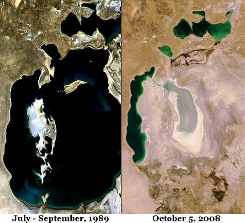
The Aral Sea (Kazakh: Арал Теңізі (Aral Tengizi), Uzbek: Orol dengizi, Russian Аральскοе мοре) is a landlocked endorheic sea in Central Asia; it lies between Kazakhstan in the north and Karakalpakstan, an autonomous region of Uzbekistan, in the south. The name comes from Aral-denghiz, Kirghiz for "the Sea of Islands." Since the 1960s the Aral Sea has been drying out and shrinking, as the rivers that feed it (the Amu Darya and the Syr Darya) were diverted by the then Soviet Union for irrigation. The Aral Sea is heavily polluted, largely as the result of weapons testing, industrial projects, and fertilizer runoff.
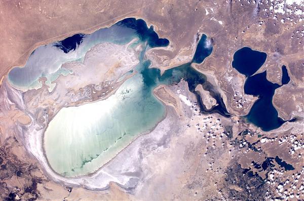
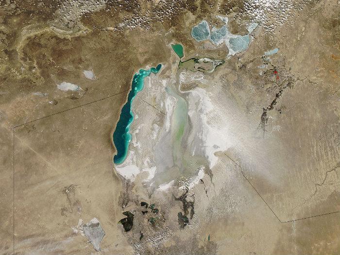
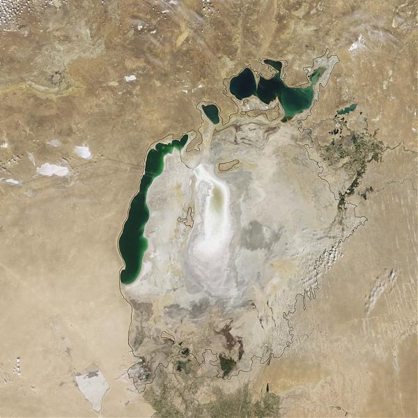
It is currently split into three parts: Northern, Western and Eastern (or Southern), separated by dry land.
It is currently split into three parts: Northern, Western and Eastern (or Southern), separated by dry land.
Wikipedia article: http://en.wikipedia.org/wiki/Aral_Sea
Nearby cities:
Coordinates: 45°2'8"N 60°17'54"E
This article is protected.
- Sands can be reached by car at full power 327 km
- Dasht-e Kavir 1219 km
- Shomal Garbi Reg-e Jenn Desert 1293 km
- Dome Rig-e Jenn Desert 1374 km
- Dasht-e Lut 1413 km
- Desert Taklamakan 1457 km
- Aghda (Siah Kooh Kevir) playa 1458 km
- Negev 2725 km
- Gobi Desert 3188 km
- Badain Jaran Desert 3415 km
- East Aral Lake 55 km
- Vozrozhdeniya Island 83 km
- Tract (island) Konstantin 96 km
- Amu Darya River Delta 126 km
- Lake Dzhaltyrbas 160 km
- Ancient city of Aq Qala 163 km
- Ruined town of Taldik 170 km
- Lake Sarybas (Yellow Head) 171 km
- Dam on the Amu Darya River 182 km
- Shegekol Reservoir 192 km