Bench Mark
USA /
California /
Furnace Creek /
World
/ USA
/ California
/ Furnace Creek
World / United States / California
beach, survey, interesting place
US Coast and Geodetic Survey marker shows this spot to be 279 below sea level.
Well . . . does not appear a Bench Mark was actually placed at this location. The USGS topo shows a spot elevation was measured at this location
mapper.acme.com/?ll=36.250278,-116.825833&z=12&...
but it does not show a Bench Mark (a type of survey marker) was actually placed at this location.
Well . . . does not appear a Bench Mark was actually placed at this location. The USGS topo shows a spot elevation was measured at this location
mapper.acme.com/?ll=36.250278,-116.825833&z=12&...
but it does not show a Bench Mark (a type of survey marker) was actually placed at this location.
Wikipedia article: http://en.wikipedia.org/wiki/Benchmark_(surveying)
Nearby cities:
Coordinates: 36°13'51"N 116°46'17"W
- Shoreline Butte 34 km
- Huntington Beach State Park 308 km
- Crystal Cove State Park 311 km
- Salton Sea State Recreation Area 313 km
- Trestles 325 km
- Red Beach 333 km
- Leucadia 353 km
- Silver Strand State Beach 401 km
- Tijuana Beach 413 km
- Rosarito 425 km
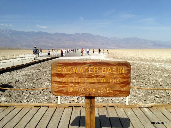
- Badwater Basin 4.4 km
- Devil's Golf Course 9 km
- Alluvial Fan 12 km
- Deb Analog 16 km
- Death Valley National Park 25 km
- Panamint Range 33 km
- Supersonic Low Level test area 50 km
- Panamint Valley 53 km
- Cottonwood Mountains 80 km
- Naval Air Weapons Station China Lake, North Range 86 km