Inmarsat Satellite Access Station, Paumalu
USA /
Hawaii /
Pupukea /
Comsat Road
World
/ USA
/ Hawaii
/ Pupukea
World / United States / Hawaii
satellite/space tracking station
Add category
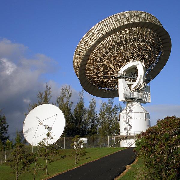
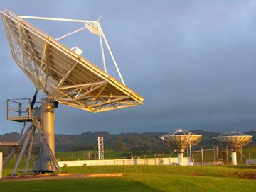
Inmarsat Broadband Global Area Network Satellite Access Station.
operates a fully redundant terrestrial network.
Our satellite access stations in Paumalu, Burum and Fucino are linked by leased fiber to each other and to the network and satellite operation centre in London.
A range of direct interconnect options are available in consultation with Inmarsat's distribution partners.
Inmarsat protects the satellite command links with NSA type-1 encryption.
Wikipedia article: http://en.wikipedia.org/wiki/INMARSAT
Nearby cities:
Coordinates: 21°40'12"N 158°2'0"W
- Kaena Point Satellite Tracking Station 27 km
- Raytheon Intelligence & Space (RIS) 4105 km
- Goldstone Deep Space Communications Tracking Station 4265 km
- Fairbanks Command & Data Acquisition Station (FCDAS) 4882 km
- EROS Data Center 6098 km
- Navy Information Operations Command Sugar Grove 7589 km
- NRO "Area 58" Aerospace Data Facility" 7765 km
- Madley Earth Station 11484 km
- Goonhilly Satellite Earth Station 11616 km
- Madrid Deep Space Communications Complex (MDSCC) - Robledo de Chavela, Spain 12609 km
- North Shore of O'ahu 0.2 km
- Pūpūkea-Paumalū Preserve 1.6 km
- Pūpūkea Forest Reserve 3.3 km
- Waimea Valley - Natural and Cultural Park 4.6 km
- Kahuku Military Training Area 4.8 km
- Kawela-Kahuku Conservation Easement 5.6 km
- James Campbell National Wildlife Refuge 8 km
- Waimea Native Forest Preserve 8.1 km
- Oʻahu 22 km
- Kaʻieʻie Waho Channel 71 km
Comments