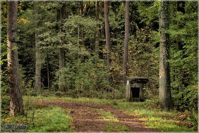
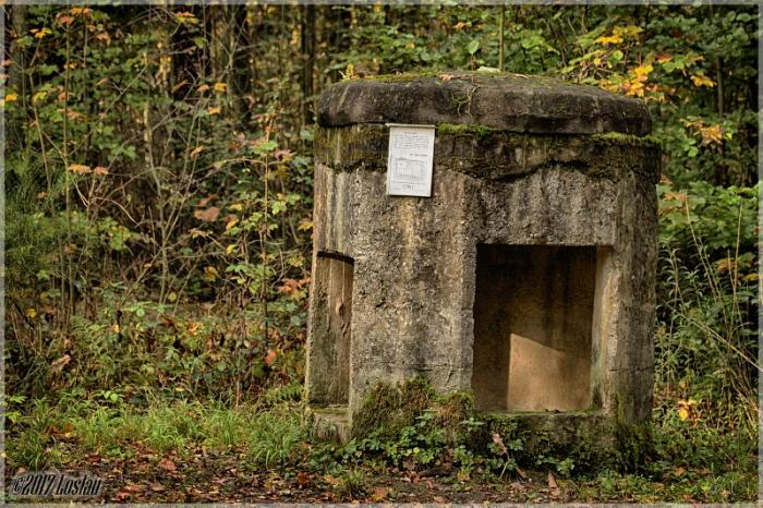
Westwall (Siegfried-Linie) "Kochbunker"
Germany /
Rheinland-Pfalz /
Vollmersweiler /
World
/ Germany
/ Rheinland-Pfalz
/ Vollmersweiler
Second World War 1939-1945, military, place with historical importance, bunker
Nearby cities:
Coordinates: 49°2'45"N 8°5'17"E
- former psp 76 9 km
- l'ouvrage Schoenenbourg. (Schoenenbourg Fort) 15 km
- Ligne Maginot : Hochwald Est 17 km
- Drachenbronn basecamp facility 18 km
- Former Neureut Kaserne 22 km
- Airbase 901 Drachenbronn radar 22 km
- Ligne Maginot Gros Ouvrage Four a Chaux 22 km
- Ligne Maginot Petit Ouvrage Lembach 24 km
- Germersheim Army Depot (TCSP-E) 28 km
- Former 193rd. Military Police Company 28 km
- Ruin of WWII Bunker 1.8 km
- Ruin of WWII Bunker 4.6 km
- Ruin of WWII Bunker 4.7 km
- Erlenbach 10 km
- Wind turbinе 13 km
- Wind turbinе 14 km
- Wind turbinе 14 km
- Wind turbinе 14 km
- Upper Rhine Graben 30 km
- Alsace 98 km