AT&T "Hagerstown 2" Project Office
USA /
Maryland /
Clear Spring /
World
/ USA
/ Maryland
/ Clear Spring
World / United States / Maryland
military, Cold War 1947-1991, telecommunication, bunker, microwave tower / microwave transmission, tropospheric scatter station
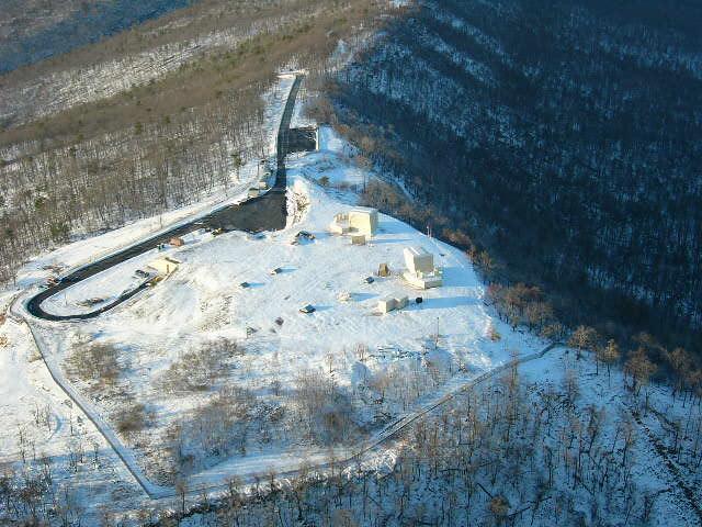
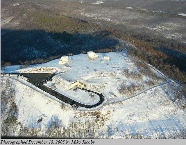
Terminal station on the AT&T Long Lines Project Office chain of troposcatter communications stations, the Hagerstown or HAG2 site went online in 1963 servicing the US Military Automatic Voice Network (AUTOVON) communications network via a troposcatter link to the Peters Mountain relay site to the S. Through co-located microwave transmitters, this site also served as the primary link to to Raven Rock (AJCC) to the backup command center at Ft. Bragg, NC via the Chatham site at the southernmost end of the Project Office chain. In addition to these over-air connections the site was also linked via subterranean cable to the adjacent Cannonball CoG site and the Long Lines cable network to the North.
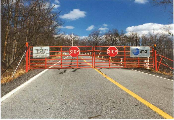
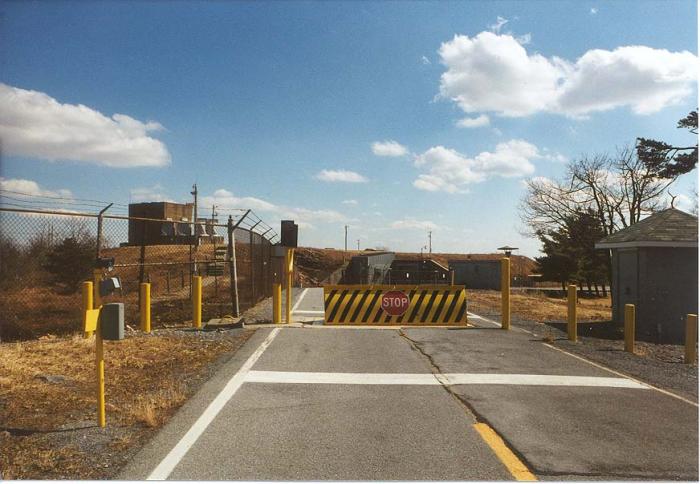
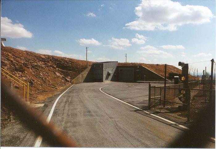
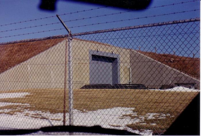
Like the other Project Office sites, all site infrastructure was located below ground in a nuclear-hardened bunker which was equipped to survive, operate and self-sustain for an extended period in the event of attack. The site is still owned and operated by AT&T and was extensively upgraded as recently as 2007 with modern communications equipment, though the troposcatter links are no longer operational.
www.coldwar-c4i.net/ATT_Project/HGTWMDQ0010/index.html
Wikipedia article: https://en.wikipedia.org/wiki/Project_Offices
Nearby cities:
Coordinates: 39°42'43"N 77°58'22"W
- Major AT&T Long Line Cable Segment Path 22 km
- Eastern WV Regional Airport/Shepherd Field (MRB/KMRB) 33 km
- Letterkenny Army Depot 43 km
- AT&T Long LInes Fiber Trunks from Thurmont and Camp David 50 km
- Fort George G. Meade 122 km
- Davidsonville Transmitter Site 136 km
- Fort Indiantown Gap Cantonment 143 km
- Aberdeen Proving Ground 149 km
- Aberdeen Proving Grounds Test Track 150 km
- Former United States Naval Training Center, Bainbridge 160 km
- Whitetail Ski Resort 4.6 km
- Claud E. Kitchens Outdoor School at Fairview 6.1 km
- Clear Spring Middle School and High School Campus 6.6 km
- Whitetail Golf Resort 7.1 km
- Interstate 70 Exit 18 8 km
- Washington County, Maryland 22 km
- Fulton County, Pennsylvania 29 km
- Morgan County, West Virginia 30 km
- Franklin County, Pennsylvania 37 km
- Mason Dixon Line 132 km