Fort Indiantown Gap Cantonment
USA /
Pennsylvania /
Fort Indiantown Gap /
World
/ USA
/ Pennsylvania
/ Fort Indiantown Gap
World / United States / Pennsylvania
military, camp, National Guard (USA)

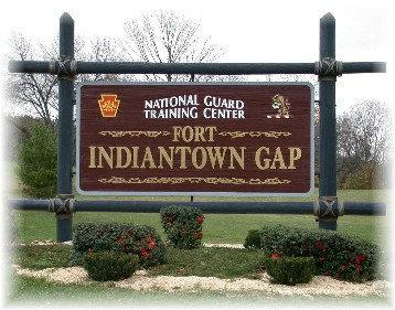
Fort Indiantown Gap
A 19,600 acre Army post, which is a sub-installation of Fort Meade (located outside of Washington DC). It has a bomb disposal facility and training center, and around 1,500 employees. Mostly National Guard operations. Fort Indiantown Gap, also referred to as "The Gap" or "FIG", is a census-designated place and U.S. Army post primarily located in Lebanon County, Pennsylvania.
The installation is an active National Guard Training Center and serves as headquarters for the Pennsylvania Department of Military and Veterans Affairs and the Pennsylvania National Guard. The fort surrounds Memorial Lake State Park.
The Fort Indiantown Gap Military Reservation is protected by a full time police force. The Fort Indiantown Gap Police enforce traffic and other state laws. The post includes 18,000 acres (73 km2), with numerous ranges and training areas for the 28th Infantry Division, the 213th Area Support Group and the Eastern Army National Guard Aviation Training Site (EAATS). The installation is also home to the Northeast Counterdrug Training Center (NCTC).
Order of Battle
State headquarters of the Pennsylvania Army and Air National Guard
35 separate Army and Air Guard units drill here, with a total of 3,500 drilling members
140 maneuver areas, firing ranges and bivouac sites
166th Regiment (Combat Arms),
a regional training academy with state-of-the-art distance learning capability
Eastern Army National Guard Aviation Training Site,
the only reserve component training center for utility and medium-lift helicopters
Muir Army Airfield, second busiest helicopter base in the world
Air-to-Ground Bomb Range for active and reserve fighter pilots from all the services
3rd Weapons of Mass Destruction Civil Support Team
www.dmva.state.pa.us/ftig/site/default.asp
www.globalsecurity.org/military/facility/fort-indiantow...
Wikipedia article: http://en.wikipedia.org/wiki/Fort_Indiantown_Gap,_PA
Nearby cities:
Coordinates: 40°26'0"N 76°33'54"W
- Naval Support Activity (NAVSUP) 43 km
- Former United States Naval Training Center, Bainbridge 98 km
- Aberdeen Proving Ground 107 km
- Letterkenny Army Depot 109 km
- AT&T Long LInes Fiber Trunks from Thurmont and Camp David 117 km
- Aberdeen Proving Grounds Test Track 123 km
- Fort George G. Meade 146 km
- Major AT&T Long Line Cable Segment Path 159 km
- Davidsonville Transmitter Site 162 km
- Eastern WV Regional Airport/Shepherd Field (MRB/KMRB) 167 km
- Swatara Township 7.8 km
- Annville, Pennsylvania 12 km
- Cleona, Pennsylvania 13 km
- Palmyra, Pennsylvania 14 km
- North Lebanon Township 14 km
- Lebanon County, Pennsylvania 14 km
- South Annville Township 16 km
- North Cornwall Township 17 km
- Hershey, Pennsylvania 18 km
- Dauphin County, Pennsylvania 19 km