Cranford Airport (site) (Cerritos, California)
| historic site
USA /
California /
La Palma /
Cerritos, California
World
/ USA
/ California
/ La Palma
airport, historic site
Operated from 1945 through approximately 1954.
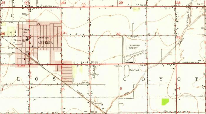
The 1949 USGS topo map depicts Cranford as consisting of two 2,300' runways, one oriented north/south & the other northeast/southwest. Each runway had a parallel taxiway, and a ramp along the south side of the field had 2 buildings (hangars?). -- per below link.
www.airfields-freeman.com/CA/Airfields_CA_LongBeach.htm
Nearby cities:
Coordinates: 33°51'44"N 118°3'2"W
- Chinese Camp, California 497 km
- Jamestown, California 506 km
- El Dorado, California 594 km
- Malakoff Diggins State Historic Park 667 km
- Sitting Bull Sun Dance Camp 1634 km
- Battle Of Honsinger Bluff 1716 km
- Rogers Pass 1950 km
- Watkins Woolen Mill State Park and State Historic Site 2204 km
- Montgomery Place 2224 km
- Adam-ondi-Ahman 2239 km
- Forest Lawn Memorial Park 3 km
- Cerritos Auto Square 4.6 km
- El Dorado Park 5.8 km
- Los Alamitos Race Course 6.2 km
- Heartwell Park 7.4 km
- El Dorado Park West 7.8 km
- El Dorado Park Golf Course 7.8 km
- Navy Golf Course Seal Beach 7.9 km
- Joint Forces Training Base, Los Alamitos 7.9 km
- Rossmoor, California 8.6 km