SS Cape May (T-AKR-5063)
USA /
Virginia /
Portsmouth /
World
/ USA
/ Virginia
/ Portsmouth
World / United States / North Carolina
military, barge, United States Navy
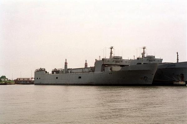
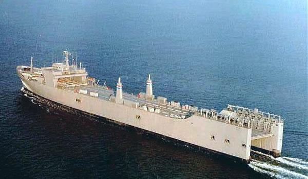
Built in 1971 for the commercial trades as the SS Almeria Lykes, this heavy-lift LASH Barge Carrier served in the commercial trades until 1986 when she was purchased by the Maritime Administration along with her two sisterships.
Renamed SS Cape May, a Cape M Class Heavy Lift Barge Carrier, she is presently operated by the Military Sealift Command as a member of the Ready Reserve Force (RRF), and is maintained in FOS-5n status, meaning she can be fully operational in 5 days or less.
www.marad.dot.gov/sh/ShipHistory/Detail/774
www.navsource.org/archives/09/54/545063.htm
Nearby cities:
Coordinates: 36°55'56"N 76°19'53"W
- Naval Station Norfolk (NGU/KNGU) 3.5 km
- Norfolk, Virginia 4.2 km
- Battle of Hampton Roads 12 km
- Naval Amphibious Base Little Creek 12 km
- Langley Air Force Base (LFI/KLFI) 20 km
- Joint Expeditionary Base Fort Story 25 km
- Naval Air Station Oceana (NTU/KNTU) 26 km
- Naval Auxiliary Landing Field Fentress (NFE/KNFE) 29 km
- Naval Air Station Oceana - Dam Neck Annex 35 km
- Fort Eustis 38 km
- Norfolk International Terminals 2 km
- Willoughby Bay 4.1 km
- Craney Island 4.3 km
- Mouth of the Lafayette River 4.6 km
- Larchmont-Edgewater Neighborhood 4.8 km
- Norfolk Southern Lambert's Point Coal Terminal 6.8 km
- Virginia International Gateway (VIG) 6.9 km
- Hampton Roads 7.2 km
- Park Place 7.4 km
- Chesapeake Bay Impact Crater 49 km
Comments