Nikopol Raion
Ukraine /
Dnipropetrovska /
Hirnytske /
World
/ Ukraine
/ Dnipropetrovska
/ Hirnytske
, 19 km from center (Гірницьке)
historical layer / disappeared object
Add category
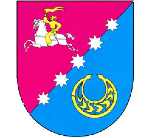
Nikopol Raion (Ukrainian: Нікопольський район, Nikopolskyi raion) is an administrative subdivision (raion) of Dnipropetrovsk Oblast, Ukraine, with the administrative center in the city of Nikopol. Its territory is 1,940 km2. (second largest among the raions). Population: 42,189 (2013 est.).
Within its territory, in addition to its capital of Nikopol, there are 68 settlements subordinated to it, of which 63 villages, 4 minor rural-type settlements and 1 urban-type settlement (Chervonohryhorivka). Nikopol itself is incorporated separately as a city of oblast significance and does not belong to the raion.
The southern border of the raion is by the Kakhovka Reservoir by the Dnieper River.
Wikipedia article: https://en.wikipedia.org/wiki/Nikopol_Raion
Nearby cities:
Coordinates: 47°44'47"N 34°17'58"E
- Ekaterinovka No. 2 15 km
- Tube Drawing Shop №1, NSPP "UTIST" 18 km
- Tube Rolling Shop №1, NSPP "UTIST" 18 km
- Basanskyj maidan 30 km
- Tomakivka Raion 34 km
- Kichkas 60 km
- Velyka Lepetykha Raion 62 km
- Garden 63 km
- Pereverzivka (abandoned) 85 km
- Siri Khutory (Staroivanivka) 91 km
- Football field 6.2 km
- Cemetery 6.9 km
- Cemetery 10 km
- Nikopol Ferroalloy Plant 14 km
- Kakhovka Reservoir 58 km