Center of Europe
Lithuania /
Vilniaus /
Nemencine /
World
/ Lithuania
/ Vilniaus
/ Nemencine
World / Lithuania / Vilniaus
interesting place, draw only border, geodetic point


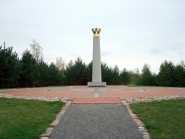


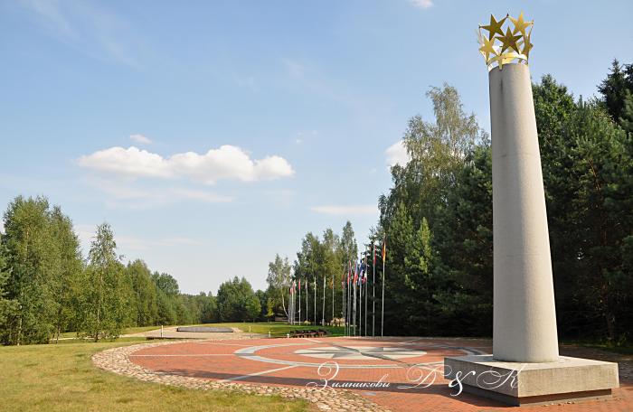
After a re-estimation of the boundaries of the continent of Europe in 1989, Jean-George Affholder, a scientist at the Institut Géographique National determined that the Geographic Centre of Europe is located at 54°54′N, 25°19′E. The method used for calculating this point was that of the centre of gravity of the geometrical figure of Europe. This point is located in Lithuania, specifically 26 kilometres north of its capital city, Vilnius, near the village of Purnuškės. A monument, composed by the sculptor Gediminas Jokūbonis and consisting of a column of white granite surmounted by a crown of stars, was erected at the location in 2004. An area of woods and fields surrounding the geographic centre point and including Lake Girija, Bernotai Hill, and an old burial ground, was set aside as a reserve in 1992. The State Tourism Department at the Ministry of Economy of Lithuania has classified the Geographic Centre monument and its reserve as a tourist attraction. 17 km away lies Europos Parkas,
Wikipedia article: http://en.wikipedia.org/wiki/Geographical_centre_of_Europe
Nearby cities:
Coordinates: 54°54'23"N 25°19'8"E
- Liubavas manor estate 5.8 km
- Europe Park 8.4 km
- Green Lakes 11 km
- Botanical Garden of Vilnius University 19 km
- Antakalnis Cemetery 23 km
- Medininkai Castle 46 km
- Molėtai Astronomical Observatory 48 km
- Ethnocosmological museum of Lithuania 48 km
- Merkinė manor 51 km
- Dysnai festival site 93 km
- European centre golf club 0.5 km
- Paberžė eldership 7.1 km
- Riešė eldership 7.7 km
- Nemenčinė eldership 10 km
- Vilnius district municipality 10 km
- Minkeliai Lake 11 km
- Sužionys eldership 16 km
- Asveja regional park 18 km