Demolished complex of buildings
Romania /
Sibiu /
Piața Mare / Large Square
World
/ Romania
/ Sibiu
/ Sibiu
demolished, historical layer / disappeared object, 18th century construction, 15th century construction
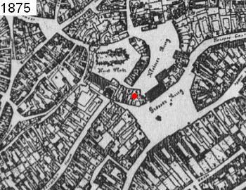


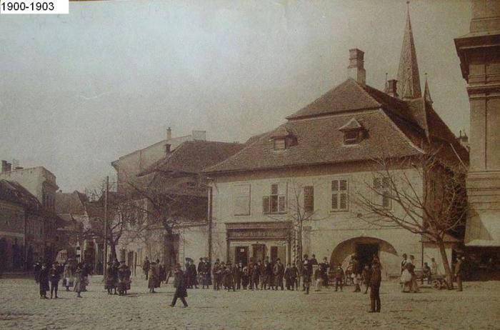
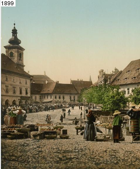
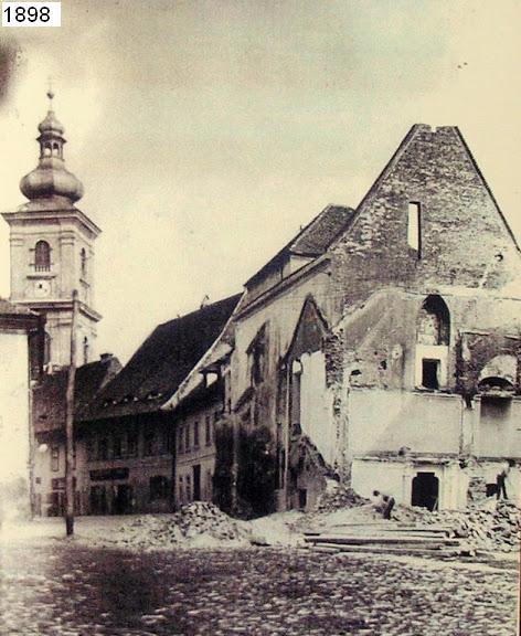
Complex of buildings, located between Piata Mare/Large Sq and Piata Mica/Small Sq, demolished in two stages:
- The first phase, demolition of the west side (with the adjoining Chapel of St. Ladislaus, Priests Tower, Gulden house) in 1898 to build the current building on S. Brukenthal Street No.4.
- The second phase, the demolition of the east side, toward Piata Mare/Large Sq, between 1903-1904 to build the Land Credit Bank Palace (current City Hall).
This complex of buildings was built starting with the first half of the 15th century, on the place of fortifications belonging to the second belt of fortifications encircling current Piata Mica/Small Sq.
Along with this complex was demolished an old defense tower belonging to the second fortification belt, located in the west end of the complex.
Through this tower was made the access to Piata Mare/Large Sq, from direction of Mitropoliei and Odobescu streets.
The tower lost its defensive role in the early-mid 14th century, being transformed and embedded in the complex of houses.
Nearby cities:
Coordinates: 45°47'49"N 24°9'2"E
- Former Sitex Dumbrava Factory 6.9 km
- Former Dumbraveni Greenhouses 57 km
- The EX Siemens-Martin Steelwork No.2 98 km
- Prescon factory 116 km
- Fosta Fabrica de hartie 116 km
- Location funicular „Teledinamicul (The American Cableway)” - Built Angel Saligny 197 km
- Former Sil Petroforest Foresta 211 km
- Former "Reconstructia" Paper mill 212 km
- Military Instalation 220 km
- Former Sugar plant Nörten-Hardenberg 1227 km
- Huet and Lesser/Small Squares - fortified perimeter finished around 1224-1240 (Cibinium) 0.1 km
- Historic Center 0.1 km
- Upper Town 0.2 km
- Lower Town 0.2 km
- Citadel Park--The Promenade 0.4 km
- Central Area (outside the Historic Center) 0.6 km
- Former Josephine district 0.8 km
- Terezian 1.2 km
- Sibiu 1.5 km
- Sibiu County 14 km