Cella
| temple, historic ruins
Syria /
Tartus /
Duraykis /
World
/ Syria
/ Tartus
/ Duraykis
, 14 km from center (دريكيش)
temple, historic ruins
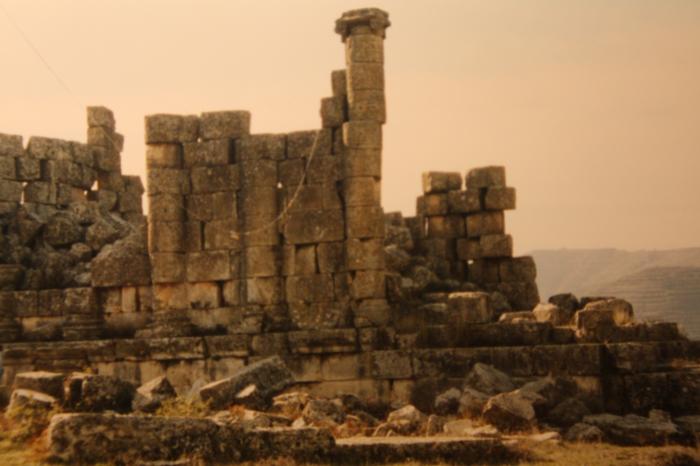
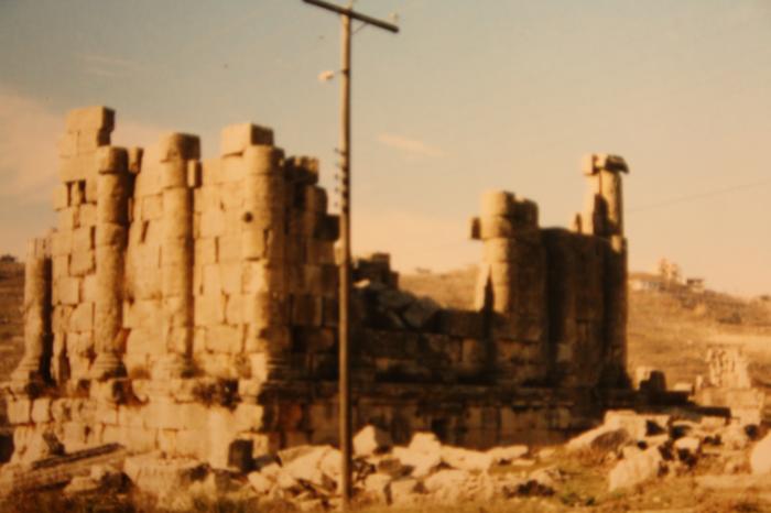
central building took the form of a pseudo-peripteros - half columnx ranged along each side to simulate the surrounding colonnades like Palmyra. The entrance in the north is marked by a portico of six free-standing columns. An altar for offerings stood in front of this platform.
Nearby cities:
Coordinates: 34°55'49"N 36°14'43"E
- Raphanaia / Rafaniyyah 14 km
- Bara - ancient Kapropera 89 km
- Ruwayha 99 km
- Baziher 165 km
- Bi’r al Bukhārah 193 km
- Salamis 216 km
- Stone Walls, kite side wall 247 km
- Najm archaeological site 256 km
- Umm Qais - Gadara 258 km
- Caesarea Maritima 297 km
- Sebei Subdistrict (Nahiyah) 2.7 km
- Dweir Ruslan Subdistrict (Nahiyah) 3.5 km
- Mashta al-Helu Subdistrict (Nahiyah) 6.1 km
- Wadi al-Uyun Subdistrict (Nahiyah) 6.7 km
- Ayn Halaqim subdistrict (Damascus-PCS) 7.5 km
- Duraykish Subdistrict (Nahiyah) 10 km
- Safita Subdistrict (Nahiyah) 16 km
- Shin Subdistrict 18 km
- Bargylus Mountains 59 km
- Hama Governorate (PCS) 100 km