Samana Bay
Dominican Republic /
Hato Mayor /
Sabana de la Mar /
World
/ Dominican Republic
/ Hato Mayor
/ Sabana de la Mar
water, bay, invisible
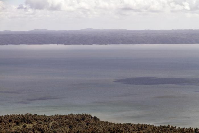
Samaná Bay is a bay in the eastern Dominican Republic. The Yuna River flows into the Samaná Bay, and it is located south of the town and peninsula of Samaná.
Among its features are protected islands that serve as nesting sites for pelicans and frigate birds, caves with pre-Columbian pictographs and petroglyphs, and mangrove-lined river tributaries. In the winter, many whales calve in the bay.
Adjoining the bay is Los Haitises National Park, which is popular with national and international ecotourist visitors.
Has 4 star hotels also in the Samana Bay.
Wikipedia article: http://en.wikipedia.org/wiki/Samaná_Bay
Nearby cities:
Coordinates: 19°6'58"N 69°25'0"W
- Coro Gulf 831 km
- Gulf of Venezuela 853 km
- Golfo De Morrosquillo 1260 km
- Gulf of Panama 1639 km
- Gulf of Montijo 1789 km
- Gulf of Chiriquí 1885 km
- Golfo Dulce 1906 km
- Ascension Bay 1925 km
- Gulf of Papagayo 1992 km
- Gulf of Fonseca 2073 km
- Arroyo Barril International Airport 9 km
- The Bannister Hotel 11 km
- Samana Harbour 13 km
- Cayo Levantado 16 km
- El Limón 20 km
- Playa Rincón 26 km
- Las Galeras 30 km
- Club Med Michès Playa Esmeralda 44 km
- Laguna Redonda 52 km
- Santa Rita 68 km