U.S. Government Barracks (Jeffersonville, Indiana)
USA /
Indiana /
Jeffersonville /
Jeffersonville, Indiana
World
/ USA
/ Indiana
/ Jeffersonville
barracks, historical layer / disappeared object
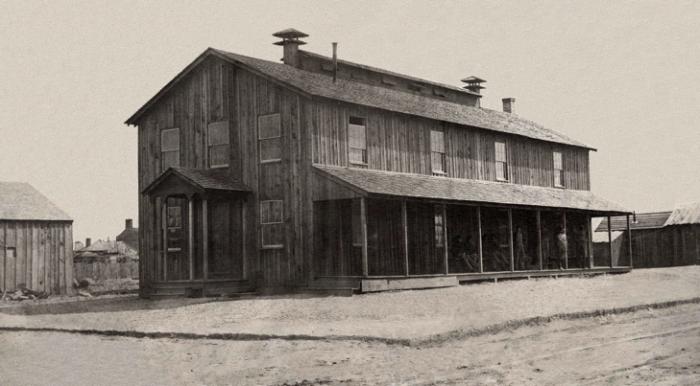
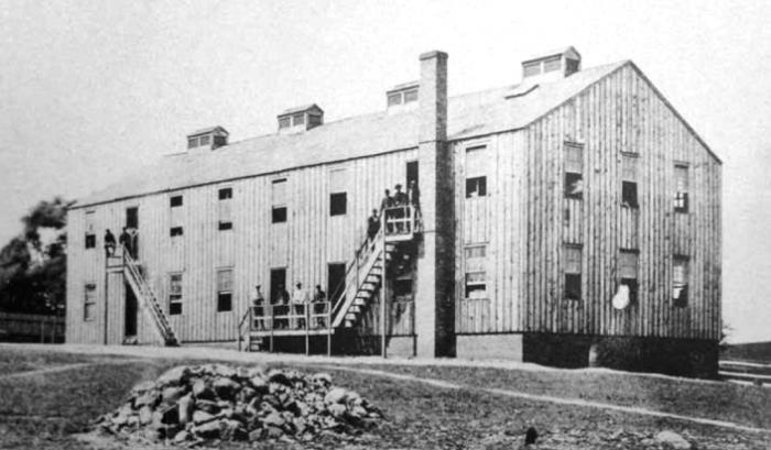
Civil War era barracks.
Nearby cities:
Coordinates: 38°16'46"N 85°44'20"W
- Weeton Barracks Camp 6241 km
- Marne Barracks 6301 km
- Queen Elizabeth Barracks (Strensall) 6350 km
- Normandy Barracks 6392 km
- Kendrew Barracks (former RAF Cottesmore) 6426 km
- Gibraltar Barracks 6477 km
- Aldershot Garrison 6483 km
- Pirbright Barracks 6487 km
- Baker Barracks 6492 km
- BASE MILITAR "ALVAREZ DE SOTOMAYOR"-- LA LEGION 7077 km
- Old Jeffersonville Historic District 0.6 km
- Atkins Quarry 2.6 km
- Falls of the Ohio National Wildlife Conservation Area 2.7 km
- Shippingport Island 3.6 km
- Ohio River Greenway 3.8 km
- Louisville and Portland Canal 3.9 km
- Portland neighborhood 4.9 km
- West End 6.3 km
- Floyd County, Indiana 14 km
- Clark County, Indiana 18 km
Comments