Falls of the Ohio National Wildlife Conservation Area
USA /
Indiana /
Clarksville /
World
/ USA
/ Indiana
/ Clarksville
World / United States / Kentucky
nature conservation park / area, National Natural Landmark
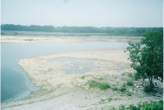


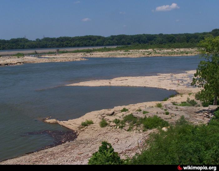

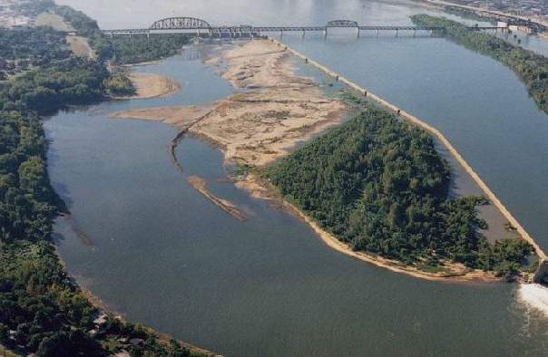
The Falls of the Ohio National Wildlife Conservation Area is a national, bi-state area on the Ohio River near Louisville, Kentucky in the United States, administered by the U.S. Army Corps of Engineers. Federal status was awarded in 1981. The area is located at the Falls of the Ohio, which was the only navigational barrier on the river in earlier times. The falls were a series of rapids formed by the relatively recent erosion of the Ohio River operating on 386 million-year-old Devonian hard limestone rock shelves.
Wikipedia article: https://en.wikipedia.org/wiki/Falls_of_the_Ohio_National_Wildlife_Conservation_Area
Nearby cities:
Coordinates: 38°16'40"N 85°46'10"W
- Okefenokee Swamp - Stephen C. Foster State Park 855 km
- McCurtain County Wilderness Area 928 km
- El Malpais National Monument 2026 km
- Glen Canyon National Recreation Area 2223 km
- Hell's Half Acre 2313 km
- Kaibab Plateau 2348 km
- Crater Lake National Park 3105 km
- Malaspina Glacier 4502 km
- Mount Veniaminof (8,225 feet /2,507 m) 5613 km
- Unga Island 5716 km
- Shippingport Island 1 km
- Ohio River Greenway 1.2 km
- Louisville and Portland Canal 1.4 km
- Portland neighborhood 2.3 km
- Old Jeffersonville Historic District 2.9 km
- Atkins Quarry 3.9 km
- West End 4 km
- Jeffersonville Industrial Park 4.4 km
- Floyd County, Indiana 11 km
- Clark County, Indiana 19 km