Long Island City (historic)
USA /
New Jersey /
West New York /
World
/ USA
/ New Jersey
/ West New York
World / United States / New York
draw only border, town district, historical layer / disappeared object, do not draw title
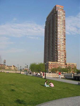
Long Island City (L.I.C.) is the westernmost district in the New York City borough of Queens. L.I.C. is notable for its rapid and ongoing gentrification, its waterfront parks, and its thriving arts community.L.I.C. has among the highest concentration of art galleries, art institutions, and studio space of any neighborhood in New York City.
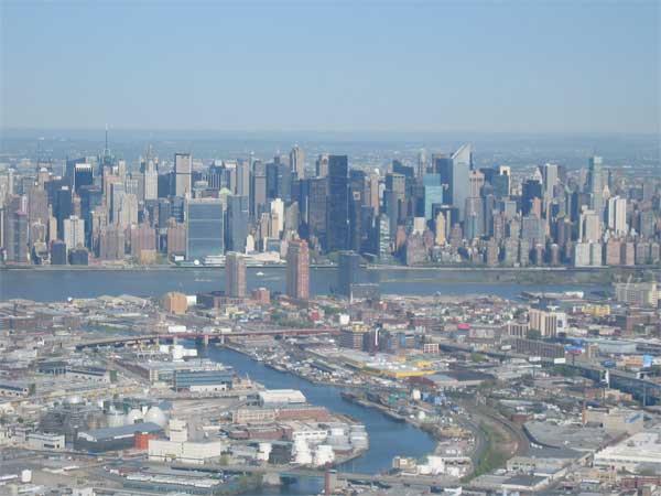
The larger historic district is bounded generally by the East River to the west and north as far as Bowery Bay; by the modern line of the BQE (Brooklyn Queens Expressway) to the east, and finally by Newton Creek to the south from the Kosciuszko Bridge to its junction with the East River.
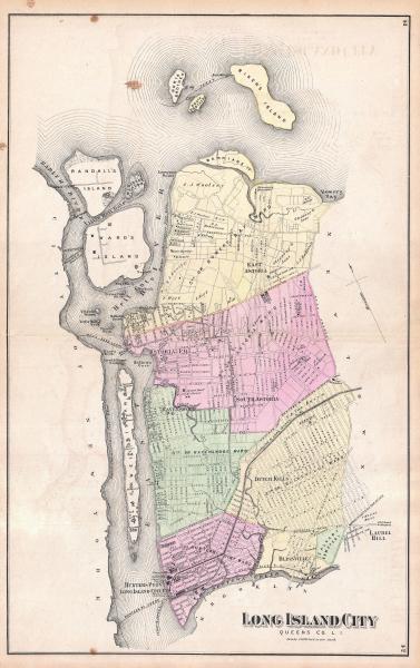
Long Island City, as its name suggests, was formerly a city, created in 1870 from the merger of the Village of Astoria and the hamlets of Ravenswood, Hunters Point, Blissville, Sunnyside, Dutch Kills, Steinway, Bowery Bay and Middleton in Newtown Township. It was a separate city until 1898. The last mayor of Long Island City was a notorious Irishman named Patrick Jerome "Battle-Axe" Gleason.
The city surrendered its independence in 1898 to become part of the City of Greater New York. However, Long Island City survives as ZIP code 11101 and ZIP code prefix 111 (with its own main post office) and was formerly a Sectional center facility (SCF). Since 1985, the Greater Astoria Historical Society, a non-profit cultural and historical organization, has been preserving the past and promoting the future of the neighborhoods that are part of historic Long Island City. The area is part of Queens Community Board 1 north of the Queensboro (59th Street) Bridge and Queens Community Board 2 south of the Bridge.
In the mid 1800s, Hunters Point, the southern tip of LIC on the East River water front, became linked with the North Fork Line of the LIRR. Ferry service also began between Wall Street and 34th Street. By 1870, when Long Island City was chartered, it had become the center of industry for Queens County. By the end of that century a major building boom had established a number of important factories as well as urban residential areas.
With the opening of the Queensborough Bridge in 1908 and the original Pennsylvania Station on the Queens waterfront in 1910, development surged eastward into Queens, leaving Long Island City as an intimate community surrounded on all sides by vast major industries.
By 1940, with the completion of The Triborough Bridge and the Queens Midtown Tunnel, Long Island City sitting next to the Sunnyside Rail Yards had become a world class industrial center though more or less a passing through point for commuters between Manhattan, Eastern Queens, and Long Island.
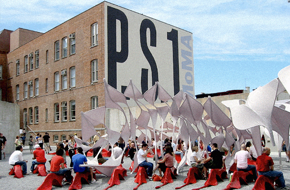
By the mid 1970s, however, due to the migration of businesses out of New York, LIC had become a small sleepy town with many empty factory and warehouse spaces. A new group began to emerge composed of younger artists and musicians who were being priced out of the tight market in Manhattan and who were drawn to the spacious lofts, unhindered light, and the almost rural quality of the neighborhood. Equally attractive was the existence of the studios of two world reknowned artists, the late Isamu Noguchi, whose studio is now a museum, and Mark DiSuvero, who established the Socrates Sculpture Park, the city's largest outdoor exhibition space. The Urban and Contemporary Arts Institute, better known as P.S. 1, at one time Public School #1, became central to the Long Island City Arts movement.
The 1980s saw greater industrial expansion in Long Island City and a rebirth of the film industry which had its early roots here. Most notably Silvercup Studios which converted an old bread factory into what would become the largest independent, full-service film and television production facility in the northeastern United States. The International Design Center of New York was opened on the site where the Sunshine bakery and Adams Chewing Gum plants stood. The Macy's warehouse became the Falchi Building, and it houses a unique artistically playful interior rivaled only by its next door neighbor, The Factory, in the old Gimbel's warehouse, with its dragon elevator and metallic slanted cut metal ceilings and walls.
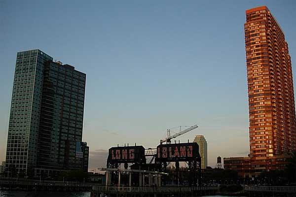
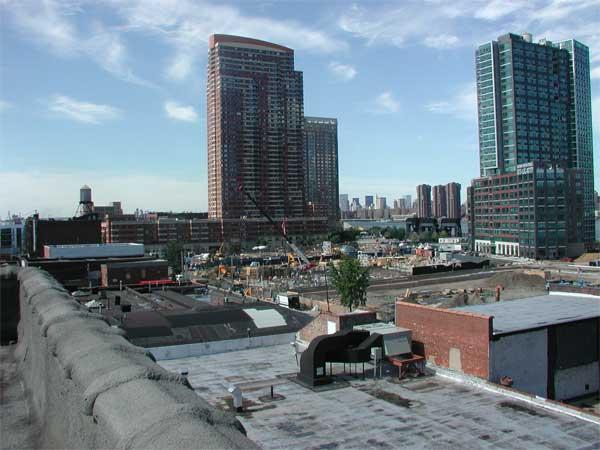
The present decade has seen continued residential and business growth, as well as the groundbreaking for the first part of the decade-long and controversial plan to develop the waterfront.
-LIC Art Institutions:
-PS1 Contemporary Art Center
-Dorsky Gallery
-Socrates Sculpture Park
-The Sculpture center
-American Museum of Moving Image
-Museum of African Art
-Isamu Noguchi Museum
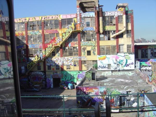
-5 Pointz - Graffiti Mecca & Home to Artists
-Fisher Landau Center for Art
The larger historic district is bounded generally by the East River to the west and north as far as Bowery Bay; by the modern line of the BQE (Brooklyn Queens Expressway) to the east, and finally by Newton Creek to the south from the Kosciuszko Bridge to its junction with the East River.
Long Island City, as its name suggests, was formerly a city, created in 1870 from the merger of the Village of Astoria and the hamlets of Ravenswood, Hunters Point, Blissville, Sunnyside, Dutch Kills, Steinway, Bowery Bay and Middleton in Newtown Township. It was a separate city until 1898. The last mayor of Long Island City was a notorious Irishman named Patrick Jerome "Battle-Axe" Gleason.
The city surrendered its independence in 1898 to become part of the City of Greater New York. However, Long Island City survives as ZIP code 11101 and ZIP code prefix 111 (with its own main post office) and was formerly a Sectional center facility (SCF). Since 1985, the Greater Astoria Historical Society, a non-profit cultural and historical organization, has been preserving the past and promoting the future of the neighborhoods that are part of historic Long Island City. The area is part of Queens Community Board 1 north of the Queensboro (59th Street) Bridge and Queens Community Board 2 south of the Bridge.
In the mid 1800s, Hunters Point, the southern tip of LIC on the East River water front, became linked with the North Fork Line of the LIRR. Ferry service also began between Wall Street and 34th Street. By 1870, when Long Island City was chartered, it had become the center of industry for Queens County. By the end of that century a major building boom had established a number of important factories as well as urban residential areas.
With the opening of the Queensborough Bridge in 1908 and the original Pennsylvania Station on the Queens waterfront in 1910, development surged eastward into Queens, leaving Long Island City as an intimate community surrounded on all sides by vast major industries.
By 1940, with the completion of The Triborough Bridge and the Queens Midtown Tunnel, Long Island City sitting next to the Sunnyside Rail Yards had become a world class industrial center though more or less a passing through point for commuters between Manhattan, Eastern Queens, and Long Island.
By the mid 1970s, however, due to the migration of businesses out of New York, LIC had become a small sleepy town with many empty factory and warehouse spaces. A new group began to emerge composed of younger artists and musicians who were being priced out of the tight market in Manhattan and who were drawn to the spacious lofts, unhindered light, and the almost rural quality of the neighborhood. Equally attractive was the existence of the studios of two world reknowned artists, the late Isamu Noguchi, whose studio is now a museum, and Mark DiSuvero, who established the Socrates Sculpture Park, the city's largest outdoor exhibition space. The Urban and Contemporary Arts Institute, better known as P.S. 1, at one time Public School #1, became central to the Long Island City Arts movement.
The 1980s saw greater industrial expansion in Long Island City and a rebirth of the film industry which had its early roots here. Most notably Silvercup Studios which converted an old bread factory into what would become the largest independent, full-service film and television production facility in the northeastern United States. The International Design Center of New York was opened on the site where the Sunshine bakery and Adams Chewing Gum plants stood. The Macy's warehouse became the Falchi Building, and it houses a unique artistically playful interior rivaled only by its next door neighbor, The Factory, in the old Gimbel's warehouse, with its dragon elevator and metallic slanted cut metal ceilings and walls.
The present decade has seen continued residential and business growth, as well as the groundbreaking for the first part of the decade-long and controversial plan to develop the waterfront.
-LIC Art Institutions:
-PS1 Contemporary Art Center
-Dorsky Gallery
-Socrates Sculpture Park
-The Sculpture center
-American Museum of Moving Image
-Museum of African Art
-Isamu Noguchi Museum
-5 Pointz - Graffiti Mecca & Home to Artists
-Fisher Landau Center for Art
Wikipedia article: http://en.wikipedia.org/wiki/Long_Island_City
Nearby cities:
Coordinates: 40°45'38"N 73°55'27"W
- Western Queens 4.9 km
- North Bergen, New Jersey 13 km
- Jersey City, New Jersey 16 km
- Manhattan 16 km
- The Bronx 17 km
- Lyndhurst, New Jersey 19 km
- Hudson County, New Jersey 22 km
- Paramus, New Jersey 29 km
- Paterson, New Jersey 31 km
- Bergen County, New Jersey 52 km
- Kaufman Astoria Studios 0.4 km
- Ravenswood Houses 0.9 km
- R Interlocking 1.1 km
- Ravenswood 1.2 km
- New York Presbyterian Church 1.2 km
- HAROLD interlocking 1.4 km
- Queens Plaza District 1.8 km
- Sunnyside Rail Yards 1.9 km
- Woodside 2.6 km
- The Palisades 23 km