Waterlogged bottom-land of the Seversky Donets and Goryachka rivers (Kamensk-Shakhtinsky)
Russia /
Rostov /
Kamensk-Shakhtinskiy /
Kamensk-Shakhtinsky
World
/ Russia
/ Rostov
/ Kamensk-Shakhtinskiy
, 4 km from center (Каменск-Шахтинский)
swamp
Add category
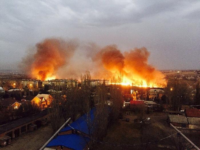
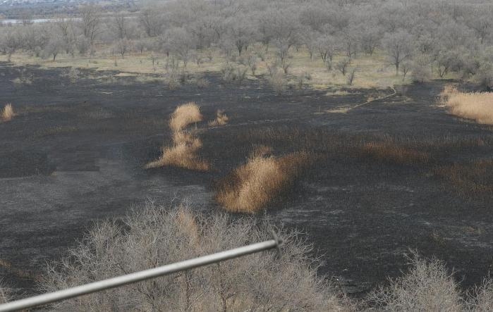
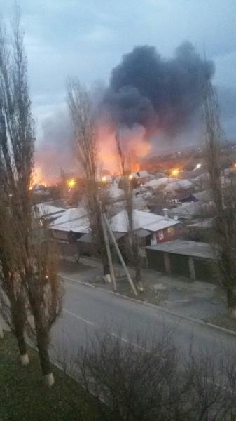
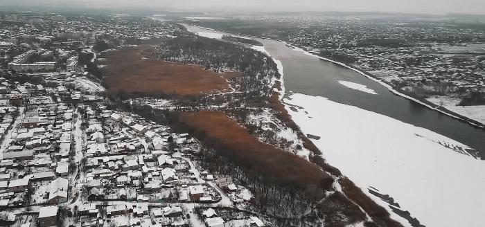
Reed wilds were set on fire on November 10, 2016.
Nearby cities:
Coordinates: 48°19'0"N 40°17'37"E
- Marshy pond 0.3 km
- Bayou in the Goryachka river flood plain 0.5 km
- Dried Up Atamanskoye ('Ataman') lake 6.2 km
- Dry Pond 53 km
- Penki lake 74 km
- Swamp 160 km
- болотце 279 km
- Former bifurcation of the Kalaus River 406 km
- Topolki ('Little Poplars') Park 0.1 km
- Garages 0.4 km
- Schastlivy Kvartal ('Happy Block of Flats') low-rise residential compound 0.5 km
- Infectious Section of the Central Municipal Hospital 0.5 km
- Bayou in the Goryachka river flood plain 0.5 km
- Kamensk-Shakhtinsky Central Municipal Hospital 0.5 km
- Goryachka river floodplain 0.5 km
- Kosonogovka 0.9 km
- Skorodumovka 1.1 km
- Mikrorayon Shestidesyatiletiya Oktyabrya 1.3 km
Topolki ('Little Poplars') Park
Garages
Schastlivy Kvartal ('Happy Block of Flats') low-rise residential compound
Infectious Section of the Central Municipal Hospital
Bayou in the Goryachka river flood plain
Kamensk-Shakhtinsky Central Municipal Hospital
Goryachka river floodplain
Kosonogovka
Skorodumovka
Mikrorayon Shestidesyatiletiya Oktyabrya