Footpath Way Marker (Nuneaton)
United Kingdom /
England /
Nuneaton /
Public Footpath (off Radley Drive, leading to and from Staff Car Park No.2 of the George Eliot Hospital)
World
/ United Kingdom
/ England
/ Nuneaton
way mark
Add category
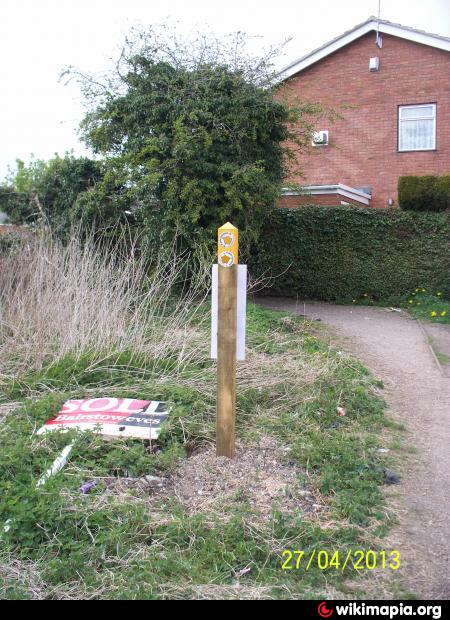
A footpath way marker situated alongside public footpath N61, and just west of Staff Car Park No.2 of the George Eliot Hospital. It is owned by the Warwickshire County Council.
Nearby cities:
Coordinates: 52°30'39"N 1°28'50"W
- Bicknoller Post 194 km
- Six Hills 4063 km
- Jebel Kamil 4129 km
- Burj at Tuyur 4307 km
- Kapoorsar. 6108 km
- Anoop from jonaicha khurd to m..na khairal 6804 km
- Road to Garjia Temple 6847 km
- way to monkey point and sunset point 7327 km
- Way to Binodpur, Begusarai 7643 km
- Way to Kurangani 8374 km
- GEH - premises 0.3 km
- Hazell Way Industrial Estate 0.4 km
- Jubilee Sports Centre Grounds 0.7 km
- Hill Top 1.3 km
- Wem Brook 1.3 km
- Bar Pool 1.4 km
- Chilvers Coton 1.6 km
- Stockingford 1.7 km
- Arbury 2.3 km
- Warwickshire 23 km