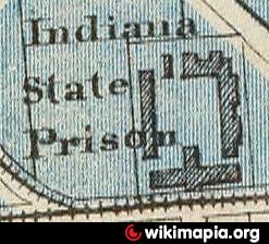
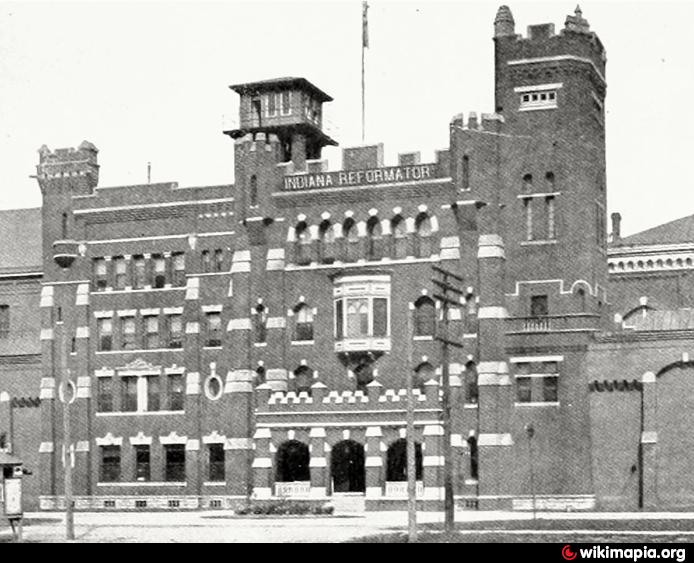
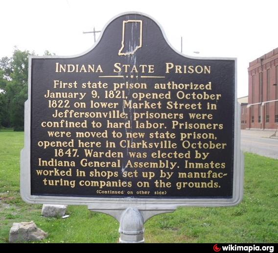
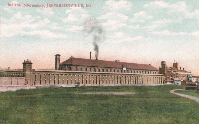
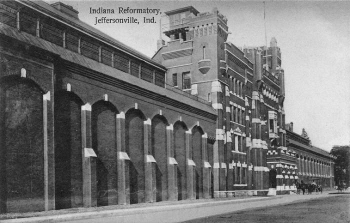
Indiana State Reformatory South (Clarksville, Indiana)
USA /
Indiana /
Jeffersonville /
Clarksville, Indiana
World
/ USA
/ Indiana
/ Jeffersonville
historical layer / disappeared object
Add category

Nearby cities:
Coordinates: 38°16'31"N 85°45'12"W
- Camp Powers 2.9 km
- Clarksville Airport 4.1 km
- Town of Ohio Falls (1854-1875) 4.1 km
- Hamburg, Indiana 12 km
- Heritage Creek, Kentucky 16 km
- Indiana Army Ammunition Plant 22 km
- Track of March, 2012 Tornado 31 km
- Former Railroad Bed 46 km
- Dog Walk Civil War Battlefield 72 km
- former site of Burnside 175 km
- Falls of the Ohio National Wildlife Conservation Area 1.4 km
- Old Jeffersonville Historic District 1.5 km
- Shippingport Island 2.3 km
- Louisville and Portland Canal 2.6 km
- Ohio River Greenway 2.6 km
- Atkins Quarry 3.3 km
- Portland neighborhood 3.6 km
- West End 5 km
- Floyd County, Indiana 13 km
- Clark County, Indiana 18 km