Paiute Cave
USA /
Arizona /
Colorado City /
World
/ USA
/ Arizona
/ Colorado City
cave / caves, petroglyph
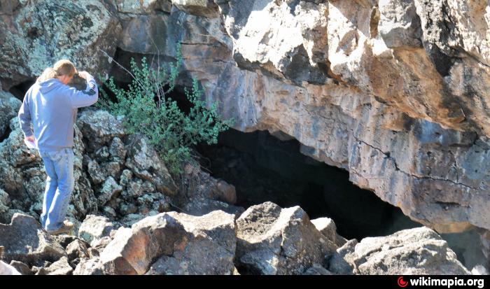
Not real easy to find this neat cave was used by the Paiute Indians, and still has some visible Pictographs inside.
For more info and driving instructions: www.in-the-desert.com/paiutecave.html
For more info and driving instructions: www.in-the-desert.com/paiutecave.html
Nearby cities:
Coordinates: 36°34'13"N 113°2'39"W
- Arden Gypsum Mines 213 km
- Montezuma Castle National Monument 243 km
- Gila Cliff Dwellings National Monument 572 km
- Wind Cave National Park 1129 km
- Naica - Cave of the Crystals 1201 km
- Mount Savona Provincial Park 1692 km
- White Ridge Provincial Park 1804 km
- Weymer Creek Provincial Park 1842 km
- Artlish Caves Provincial Park 1877 km
- Onondaga Cave State Park 1932 km
- Mt Trumbull & Wilderness Area 20 km
- Uinkaret Volcanic Field 30 km
- The Grand Canyon (west-central section) 39 km
- Grand Canyon National Park 40 km
- Havasupai Indian Reservation 59 km
- Grand Canyon Parashant National Monument 70 km
- The Grand Canyon (western section) 75 km
- Hualapai Indian Reservation 76 km
- Hualapai Indian Reservation 102 km
- Plain Tank Flat 114 km