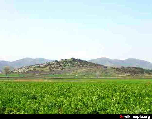
The ancient citadel (Acropolis) in the position of Island of Lake Xynias in the limits of the Village Koromilia
Greece /
Fthiytis /
Omvriaki /
World
/ Greece
/ Fthiytis
/ Omvriaki
, 6 km from center (Ομβριακή)
World / Greece / Thessalia
castle, ruins, citadel, archaeological site
The archaeological site was declared in 1936 by the Greek Cultural ministy with the encouragement
of Professor Dimitrios Holevas in 1936. (See en.wikipedia.org/wiki/Dimitrios_Holevas).
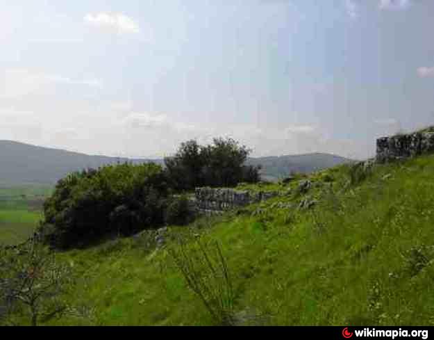
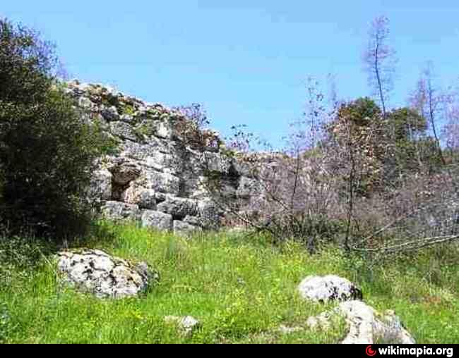
The place is full with shards and citadel walls, there are many indications that was it
inhabited from the very prehistoric times. Unfortunately no one the ministry or any universities was interested to investigate it
by archaeologists, so it remained free at illicit dealers of antiquities (antiquities theft). Even after drying out of the Lake as suspected there
was an ancient cemetery of the island following the which was destroyed by agricultural machinery.
The position of the island was strategic and has lovely view of the plateau. I believe it's still not too late to make
excavations and to uncover the secrets hidden there.
of Professor Dimitrios Holevas in 1936. (See en.wikipedia.org/wiki/Dimitrios_Holevas).
The place is full with shards and citadel walls, there are many indications that was it
inhabited from the very prehistoric times. Unfortunately no one the ministry or any universities was interested to investigate it
by archaeologists, so it remained free at illicit dealers of antiquities (antiquities theft). Even after drying out of the Lake as suspected there
was an ancient cemetery of the island following the which was destroyed by agricultural machinery.
The position of the island was strategic and has lovely view of the plateau. I believe it's still not too late to make
excavations and to uncover the secrets hidden there.
Nearby cities:
Coordinates: 39°2'14"N 22°16'5"E
- Fàrsala Ancient Field 31 km
- Fàrsala 31 km
- Strongilovouni 56 km
- Arta 113 km
- ancient Anactorium 125 km
- Αncient Nicopolis 134 km
- The cemetery of tumuli 162 km
- Archaeological Site of Hadrianopolis 206 km
- Antigonea 212 km
- Amantia 267 km
- Agios Stefanos mine 2.3 km
- Railway Tunnel Othrios. 4.1 km
- Monastery 4.2 km
- Highway Tunnel (3000 m) 4.6 km
- Settlement of Mines (Metallion) 6.2 km
- Lake Metalleio. 6.4 km
- Panagia Solar Field 8 km
- Mount Othrys 28 km
- Peripheral unit of Phthiotis 34 km
- Peripheral unit of Karditsa 49 km