Brownhills
United Kingdom /
England /
Brownhills /
World
/ United Kingdom
/ England
/ Brownhills
World / United Kingdom / England
town, district, urban/built-up area
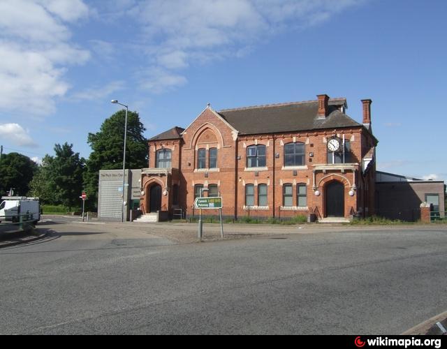
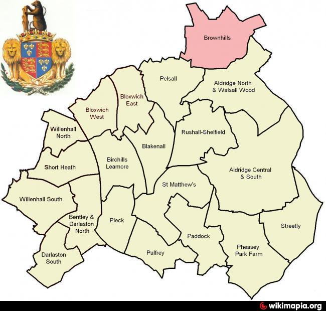
Brownhills is a town in the West Midlands, England, the northernmost part of the Metropolitan Borough of Walsall. Located on the edge of Cannock Chase near the large artificial lake Chasewater, it is 6 miles (9.7 km) north-east of Walsall and a similar distance south-west of Lichfield. As well as a part of the Metropolitan Borough of Walsall it is in the Aldridge-Brownhills parliamentary constituency and neighbours the ancient villages of Pelsall and Stonnall. Before boundary changes in 1974, it was in the county of Staffordshire.
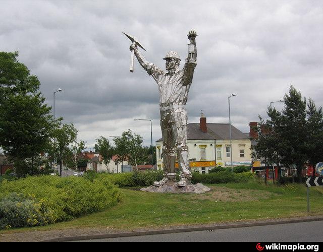
The town lies on the ancient Watling Street, but is not recorded before the 17th century, although Ogley Hay, which in modern times is a district of the town, is recorded as a settlement in the Domesday Book. Brownhills quickly grew around the coal mining industry, especially after it became linked to the canal and railway networks in the mid-19th century, and by the end of the century had grown from a hamlet of only 300 inhabitants to a town with a population of over 13,000, of whom the vast majority were employed in the coal industry. Mining remained the town's principal industry until the 1950s, but the subsequent closure of the area's pits led to a severe economic decline which has continued until the present day. The local authority has instituted a regeneration programme which it is hoped will revive the town's fortunes, providing better transport and leisure facilities.
Today the people of Brownhills are represented on Walsall MBC via their own electoral ward and the principal neighborhoods within the ward include : Brownhills Common, Catshill, Clayhanger, New Town and The Slough.
for more history of Brownshill see @:
cms.walsall.gov.uk/index/libraries_museums_and_arts/mus...
for downloadable Walsall electoral wards profile used in drawing attached polygon see @:cms.walsall.gov.uk/index/council_and_democracy/election...
Wikipedia article: http://en.wikipedia.org/wiki/Brownhills
Nearby cities:
Coordinates: 52°38'59"N 1°56'11"W
- Sutton Coldfield 5.5 km
- Walsall 5.9 km
- Telford 43 km
- Leicester 49 km
- Nottingham 60 km
- Metropolitan Borough of Stockport 90 km
- Warrington 101 km
- Doncaster 113 km
- Huddersfield 115 km
- York 160 km
- Chasewater 2.4 km
- Post Code WS7 3.2 km
- Great Wyrley CP 5.5 km
- Walsall (Metropolitan Borough of) 5.6 km
- Landfill Site & Recycling Centre 6.1 km
- Cannock Wood CP 6.2 km
- Mill Green Nature Park 7 km
- Cheslyn Hay CP 7.1 km
- Essington Civil Parish 7.4 km
- South Staffordshire 16 km