Tylihul Liman
Ukraine /
Odeska /
Dmytrivka /
World
/ Ukraine
/ Odeska
/ Dmytrivka
, 5 km from center (Дмитрівка)
World / Ukraine / Odessa
estuary
Add category

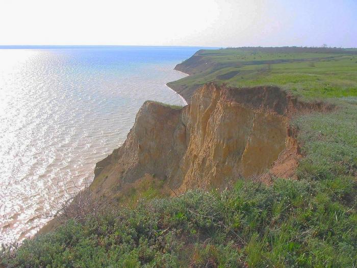


Tylihul (or Tylihulskyi) Liman (or Estuary) is a Ramsar listed government protected estuary of the Tylihul River.
It is located in Odessa Oblast (region) in the south of Ukraine, and includes an ornithological Game Reserve and the Tylihulskyi Regional Landscape Park, situated on the East coast.
The name of the water body originates from the Turkish: Deli Göl, meaning "mad, rabid lake".
Max. length: 60 km (37 mi)
Max. width: 4.5 km (2.8 mi)
Surface area: 135 km2 (52 sq mi)
Average depth: 5 m (16 ft)
Max. depth: 21 m (69 ft)
Salinity: 14–23 ‰
Wikipedia article: http://en.wikipedia.org/wiki/Tylihul_Estuary
Nearby cities:
Coordinates: 46°51'22"N 31°5'7"E
- Small Adzhalyk / Hryhorivskyi Estuary 22 km
- Berezan Liman 25 km
- Sosytsky estuary 26 km
- Kuialnyk Liman 38 km
- Dnieper Liman 40 km
- Khadzhybeiskyi Liman 51 km
- Bug Liman 61 km
- Dnister Liman 91 km
- Kalanchak estuary 173 km
- Utliukskyi Liman 315 km
- Cemetery 2.2 km
- Kalynivskyi Forest 4.1 km
- Cemetery 5.9 km
- Substation "Progresivka 330 kV" 6.7 km
- Prohresivka Solar Power Plant 7.9 km
- Pond 11 km
- Regional Landscape Park Tiligulsky 11 km
- Dobroslav Settlement Hromada 14 km
- Lyman Raion 16 km
- Berezanka Raion 17 km