Bridge of No Return
Korea (North) /
Hwanghaebukto /
Kaesong /
World
/ Korea (North)
/ Hwanghaebukto
/ Kaesong
World / North Korea / Kaesŏng
military, bridge
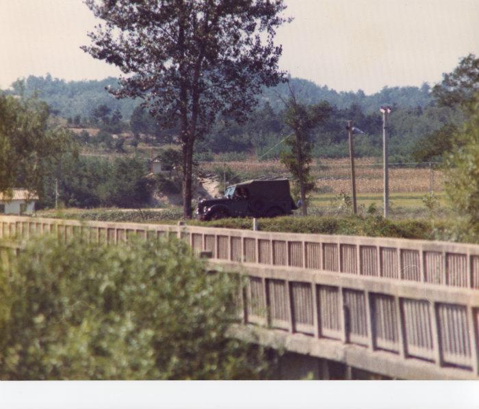

Located in the Joint Security Area, the so-called "Bridge of No Return" crosses the Military Demarcation Line between North Korea and South Korea. It was used for prisoner exchanges at the end of the Korean War in 1953. The name originates from the fact that prisoners were given the choice to remain in the country of their captivity or cross over to the other country. But if they chose to cross the bridge, they would never be allowed to return.
The last time the bridge was used was in 1968 when the crew of the USS Pueblo was released and ordered to cross into South Korea via the bridge.
The last time the bridge was used was in 1968 when the crew of the USS Pueblo was released and ordered to cross into South Korea via the bridge.
Wikipedia article: http://en.wikipedia.org/wiki/Bridge_of_No_Return
Nearby cities:
Coordinates: 37°57'21"N 126°40'14"E
- road and rail bridges 4.5 km
- Road Bridge Over The Imjingang (Imjin River) 8.3 km
- Bridge of Freedom 8.9 km
- Bridge 45 km
- Seung-Il Bridge 61 km
- Unmarked Bridge 3 A 89 km
- railway bridge 91 km
- 춘천대교 91 km
- Soyang 6 Bridge 97 km
- Sewol Bridge 98 km
- Panmunjom Joint Security Area 0.5 km
- Former Czech and Polish NNSC camp 1.6 km
- Daeseong-Dong (Freedom Village) 1.7 km
- Fortification and trenches 1.7 km
- network of trenches 2.3 km
- Camp Bonifas 5.4 km
- Camp Bonifas East 5.5 km
- Kaesong Industrial Complex (KIC) 6.6 km
- Jangphung County 19 km
- Korean Demilitarized Zone (DMZ) 54 km
Comments