Korean Demilitarized Zone (DMZ)
Korea (South) /
Kyonggi /
Pochon /
World
/ Korea (South)
/ Kyonggi
/ Pochon
World / South Korea / Gangwon-do
military, demilitarized zone, draw only border

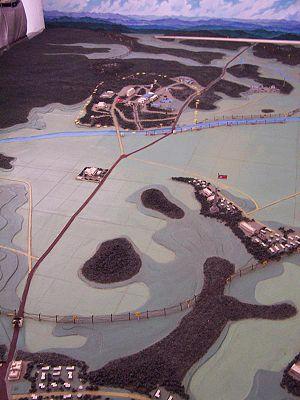
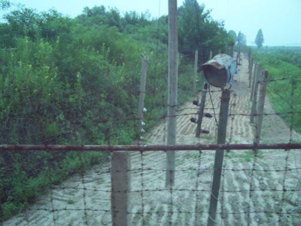

Roughly 2.5 mi (4 km) wide strip of land 238 km wide surrounding the static front lines that were established by the cease-fire process that halted the Korean war. The line reaches approx one mile on either side of the central Military Demarcation Line (MDL), which has become the de-facto border between the two Koreas. The DMZ is the most heavily fortified border in the world.
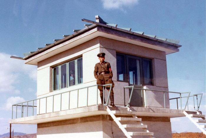
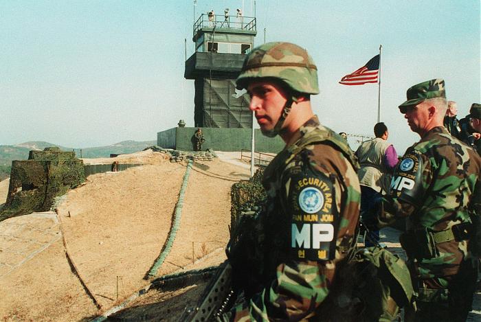
Heavy military weapons are prohibited within the DMZ, which remains largely the way it was left the day of the cease fire, with rusting military equipment scattered throughout. The borders of both sides of the DMZ are heavily fortified, with watchtowers erected every couple of miles that both sides use to observe any enemy activity within the DMZ.
Heavy military weapons are prohibited within the DMZ, which remains largely the way it was left the day of the cease fire, with rusting military equipment scattered throughout. The borders of both sides of the DMZ are heavily fortified, with watchtowers erected every couple of miles that both sides use to observe any enemy activity within the DMZ.
Wikipedia article: http://en.wikipedia.org/wiki/Korean_Demilitarized_Zone
Nearby cities:
Coordinates: 38°9'27"N 127°13'42"E
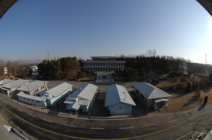
- MDL (Military Demarcation Line) 54 km
- Panmunjom Joint Security Area 54 km
- Fukushima Exclusion Zone (2020) 1182 km
- Dividing line 6772 km
- Åland Islands 7256 km
- UNDOF Zone 7918 km
- United Nations Green Line (continuation) 7957 km
- United Nations Green Line 8040 km
- United Nations Buffer Zone 8048 km
- Campo Los Álamos (Propiedad Del Gobierno De Córdoba /No Fotografiar) 18821 km
- hill 5.9 km
- Camp Kaiser 7.8 km
- Greek Valley 10 km
- St Barbara Range 14 km
- Rodriquez Range 14 km
- 1st Tab 25th Arty 15 km
- Camp St Barbara 16 km
- Chorwon County 24 km
- St Barbra 27 km
- Jangphung County 41 km
Comments