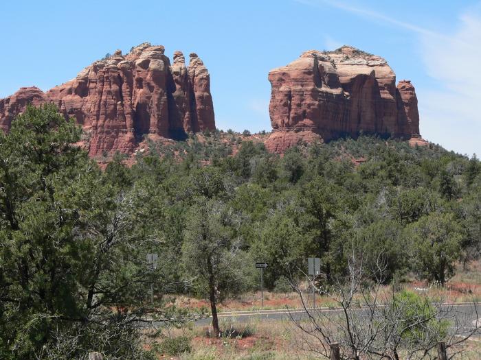
Coffeepot Rock (Sedona, Arizona)
| mountain, butte
USA /
Arizona /
Sedona /
Sedona, Arizona
World
/ USA
/ Arizona
/ Sedona
World / United States / Arizona
mountain, butte
Elevation: 5410 feet (1649 meters)
Aptly named rocky butte that has also lent its name to the nearby street
peakbagger.com/peak.aspx?pid=-97752
caltopo.com/map.html#ll=34.88481,-111.7922&z=16&b=t
Aptly named rocky butte that has also lent its name to the nearby street
peakbagger.com/peak.aspx?pid=-97752
caltopo.com/map.html#ll=34.88481,-111.7922&z=16&b=t
Nearby cities:
Coordinates: 34°53'4"N 111°47'32"W
- Snake Ridge 50 km
- San Francisco Mountain 54 km
- O'Leary Peak 66 km
- Strawberry Crater Wilderness Area 71 km
- West Sunset Mountain 71 km
- Howard Mesa 77 km
- East Sunset Mountain 79 km
- The Grand Canyon (central section) 169 km
- Red Clay Mesa 174 km
- Black Mesa 176 km
- Village of Oak Creek, Arizona 12 km
- Montezuma Well National Monument 26 km
- Lake Montezuma, Arizona 28 km
- Long Lake 54 km
- Tremaine Lake 54 km
- Blue Ridge Reservoir 65 km
- Whispering Pines 74 km
- Little Diamond Rim 74 km
- Mogollon Plateau 86 km
- Kohl's Ranch Lodge 90 km