Medina Jabal - Fort Irwin
USA /
California /
Tecopa /
World
/ USA
/ California
/ Tecopa
World / United States / California
historical layer / disappeared object
Add category
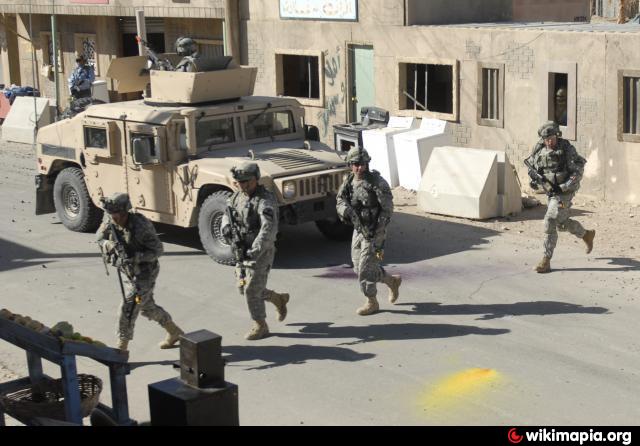
Another simulated town where military personnel from all branches (Army, Navy, Air Force, Marines) receive training in a very realistic combat/crowd control scenario.
www.nytimes.com/2006/05/01/front%20page/world/the-reach...
www.nytimes.com/2006/05/01/front%20page/world/the-reach...
Nearby cities:
Coordinates: 35°20'4"N 116°31'10"W
- Solar One power plant 59 km
- Ace Cogeneration Co. Trona 92 km
- picenter of M3.1 quake on 2015-08-04 03:40:59 (UTC) 98 km
- Center of the Trona earthquake swarm Nov. 28 to Dec. 2, 2008 104 km
- Ridgeline of Telescope Peak 107 km
- Solar Development Land 114 km
- Volkswagen’s graveyards for diesels 115 km
- Nevada Landing Hotel and Casino (site) 119 km
- Former State Route 58 Entrance Into Mojave (Abandoned) 149 km
- Abandoned Runway 155 km
- Fort Irwin National Training Center 10 km
- Bicycle Lake 12 km
- Fort Irwin NTC Main Post Area 17 km
- Desert Warfare Training area 22 km
- East Cronise Lake 32 km
- Coyote Lake 36 km
- Silver Lake 37 km
- Soda Dry Lake 46 km
- Baker Grade 53 km
- Mojave National Preserve 91 km