South Road Methodist Church (Timsbury)
United Kingdom /
England /
Paulton /
Timsbury /
South Road
World
/ United Kingdom
/ England
/ Paulton
World / United Kingdom / England
chapel
Add category
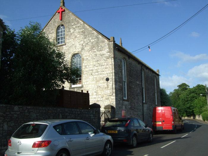
Formerly known as Wesleyan Chapel built in 1805 due to the efforts of John Evans and John Barnes.
Nearby cities:
Coordinates: 51°19'33"N 2°28'29"W
- Farleigh Hungerford Castle 13 km
- Westerleigh Crematorium 20 km
- Lytes Cary Manor 35 km
- Gorsley Baptist Chapel 67 km
- All Souls Chapel, Lockinge 81 km
- St. George's Chapel 131 km
- Chichester Cemetery 131 km
- St James Chapel Royal 163 km
- Henry VII Chapel 164 km
- Location of St Stephen's Chapel 164 km
- Lower Conygre Colliery (Disused) 0.6 km
- Wallmead House Farm 1.1 km
- Farmborough Common 1.5 km
- Site of Paulton Basin (Disused) 1.6 km
- Evidence of shaft mounds in the ploughed field 1.7 km
- Rugbourne Farm 2 km
- Priest Barrow 2.3 km
- Hobbs Wall 2.4 km
- Barrow Vale 2.7 km
- Somerset 43 km