Traders Point Covered Bridge (Indianapolis, Indiana)
USA /
Indiana /
Zionsville /
Indianapolis, Indiana
World
/ USA
/ Indiana
/ Zionsville
World / United States / Indiana
covered bridge, 1880_construction

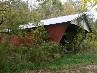
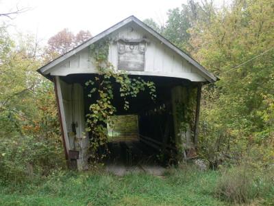

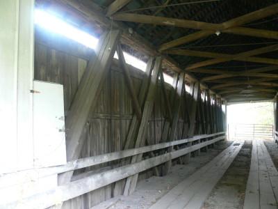


The Traders Point Covered Bridge originally crossed Fishback Creek near the community of Traders Point in Marion County. Built by Josiah Durfee in 1880, construction of Interstate 65 necessitated its removal and it was moved to the D. W. Brown Farm nearby. This single span Howe Truss structure is 88 feet long, or 108 feet including the 10-foot overhang at each end, is 14 feet wide and 13 feet high. The Traders Point Covered Bridge is the last of the old covered bridges still standing in Marion County.
Wikipedia article: http://en.wikipedia.org/wiki/List_of_Indiana_covered_bridges
Nearby cities:
Coordinates: 39°54'32"N 86°19'26"W
- Shadyside Recreation Area 61 km
- Bell Ford Bridge 109 km
- Restored Covered Bridge & Park 147 km
- Bollinger Mill State Historic Site 414 km
- Clearbranch Methodist Baptist Church and Covered Bridge 692 km
- Abandoned Bridge Piers 732 km
- Pennsylvania Railroad Bridge (Ruins/Demolished) 836 km
- Conowingo Bridge (Former Site) 865 km
- Port Deposit Bridge remnants 871 km
- Covered Bridge Park 1616 km
- Eagle Creek Golf Club 5.2 km
- Branches 5.4 km
- Eagle Creek Reservoir 6.1 km
- Eagle Creek Park 6.2 km
- Pike Township 6.3 km
- Eagle Crossing 6.6 km
- Williamsburg Village 7 km
- Lake Ridge 7 km
- Marion County 22 km
- Hendricks County, Indiana 23 km