Qualicum National Wildlife Area
Canada /
British Columbia /
Parksville /
World
/ Canada
/ British Columbia
/ Parksville
World / Canada / British Columbia / Nanaimo
park, nature conservation park / area, estuary
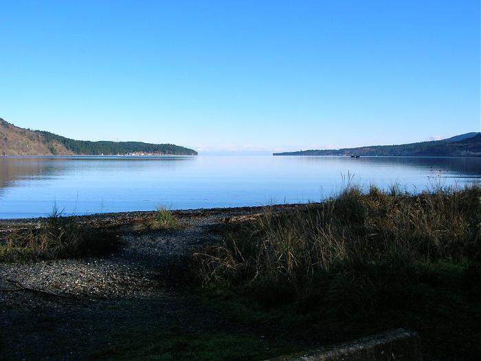
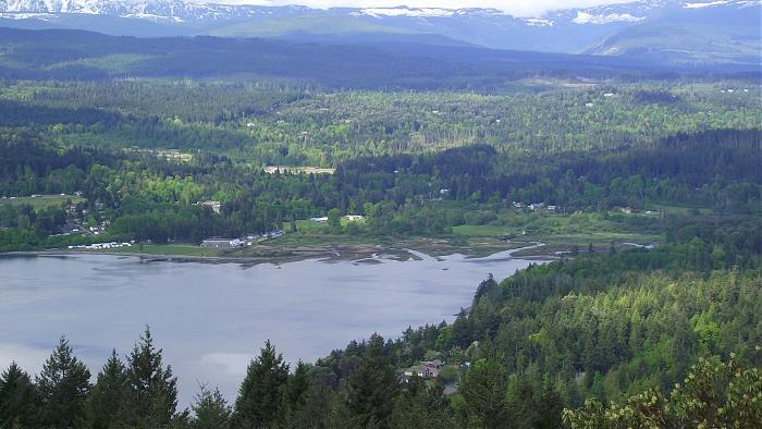
The area is 34 hectares, 14 of which are tidal. Mudflats, marine spits, wet meadows and marshes compose the terrain, which is frequented by more than 190 different types of animals (birds comprising the biggest portion at around 131). Many of the species can be seen through out the year, but some are more abundant during winter or migration (eg. bald eagles in January). The vegetation is also spectacular, with over 200 species of plants.
Two small streams, Nanoose and Bonell Creeks run through the area and enter the bay. At low tides extensive tidal flats are exposed over which the waters of the two creeks fan into many channels. Saltwort is the most common estuarine plant at low elevations followed by sandspurry and seaside plantain. On higher ground glasswort, saltgrass, sedge, rush, and bentgrass follow. Reed canary grass is most common in the native meadow. Among riparian woody species, red alder, big-leaf maple, grand fir, and western red cedar dominate with ninebark, blackberry, salmonberry, snowberry, and Nootka rose in the understory. The surrounding area is a mix of farmland, residential, and undeveloped land.
Two small streams, Nanoose and Bonell Creeks run through the area and enter the bay. At low tides extensive tidal flats are exposed over which the waters of the two creeks fan into many channels. Saltwort is the most common estuarine plant at low elevations followed by sandspurry and seaside plantain. On higher ground glasswort, saltgrass, sedge, rush, and bentgrass follow. Reed canary grass is most common in the native meadow. Among riparian woody species, red alder, big-leaf maple, grand fir, and western red cedar dominate with ninebark, blackberry, salmonberry, snowberry, and Nootka rose in the understory. The surrounding area is a mix of farmland, residential, and undeveloped land.
Wikipedia article: http://en.wikipedia.org/wiki/List_of_National_Wildlife_Areas_in_Canada
Nearby cities:
Coordinates: 49°15'58"N 124°11'38"W
- Olympic National Park 130 km
- Garibaldi Provincial Park 132 km
- Mt. Baker-Snoqualmie National Forest (Exclave - Rough Outline) 184 km
- Stein Valley Nlaka'pamux Heritage Park 187 km
- Capitol State Forest 254 km
- Saddle Mountain National Wildlife Refuge 427 km
- West Arm Provincial Park 503 km
- Waterton Lakes National Park 728 km
- Redwood National and State Parks 868 km
- Orchard Training Area 892 km
- Nanoose Bay 3.2 km
- Arbutus Grove Provincial Park 3.7 km
- Canadian Forces Maritime Experimental and Test Ranges 4 km
- Nanoose First Nation Reserve 5.4 km
- Doumont (Legacy) Marsh 6 km
- Winchelsea View Golf Course 7.3 km
- The Foothills development (under construction) 8.5 km
- Okay Lake 10 km
- Boomerang Lake 10 km
- Area WG 17 km