Slapton Sands
United Kingdom /
England /
Dartmouth /
World
/ United Kingdom
/ England
/ Dartmouth
World / United Kingdom / England
beach
Add category
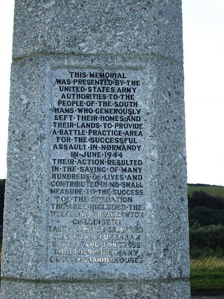
Where they practiced the D-Day landings. A very long stretch of shingle and pebble beach.
Wikipedia article: http://en.wikipedia.org/wiki/Slapton_Sands
Nearby cities:
Coordinates: 50°17'4"N 3°38'27"W
- Whitsand Bay 47 km
- Chesil Beach 83 km
- Swansea Bay beach 150 km
- Cefn Sidan Sands 170 km
- Utah Beach 196 km
- Omaha Beach 220 km
- Sword Beach 257 km
- Hermanville-sur-Mer 260 km
- Cabourg beach 270 km
- Inch Strand / Trá Inse 488 km
- Slapton Ley 1.2 km
- Start Bay, Devon 2 km
- Start Point 6.9 km
- Kingsbridge Estuary 9 km
- Prawle Point 11 km
- The Medina (Wreck) 11 km
- Bigbury Golf Club 16 km
- Thurlestone Golf Course 16 km
- Bolt Tail 17 km
- Cornwall 94 km
Comments