Gaza Strip
Palestine /
Dayr-al-Balah /
al-Magazi /
World
/ Palestine
/ Dayr-al-Balah
/ al-Magazi
, 2 km from center (المغازي)
World / Palestinian territories / Gaza
region, draw only border


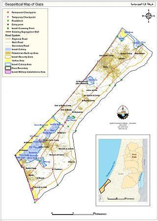
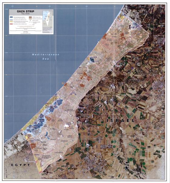

The Gaza Strip is a self-governing Palestinian territory on the eastern coast of the Mediterranean Sea that borders Egypt on the southwest for 11 kilometers and Israel on the east and north along a 51 km border. Gaza and the West Bank are claimed by the de jure sovereign State of Palestine.
www.bbc.com/news/57102499
www.idf.il/en/mini-sites/hamas-israel-war-24/all-articl...
www.bbc.com/news/57102499
www.idf.il/en/mini-sites/hamas-israel-war-24/all-articl...
Wikipedia article: http://en.wikipedia.org/wiki/Gaza_Strip
Nearby cities:
Coordinates: 31°24'29"N 34°23'36"E
- Gush Katif 17 km
- Former Erez industrial zone 22 km
- Ramot neighborhood 41 km
- Special Precinct 48 km
- Judea 55 km
- Coastal Repair Patch 57 km
- خربة حتا 64 km
- Dutch Rehovot 65 km
- Latrun 73 km
- Nerya Block 93 km
- Reforestation Area 1.5 km
- Deir al-Balah Governorate 2.7 km
- Reforestation Area 4 km
- Reforestation Area 4 km
- Reforestation Area 4.5 km
- Reforestation Area 5.3 km
- Gaza Governorate 10 km
- Khan Yunis Governorate 12 km
- Sdot Negev Regional Council 17 km
- Eshkol Regional Council 18 km
Comments