Deer's Mill Bridge
USA /
Indiana /
Alamo /
World
/ USA
/ Indiana
/ Alamo
World / United States / Indiana
footbridge, covered bridge
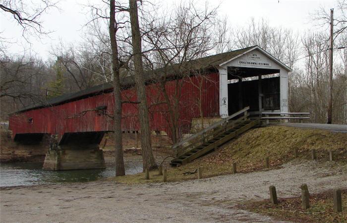
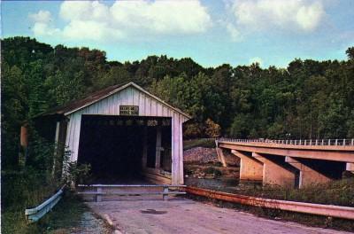
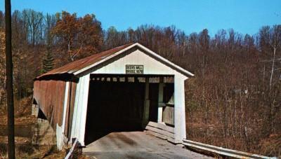
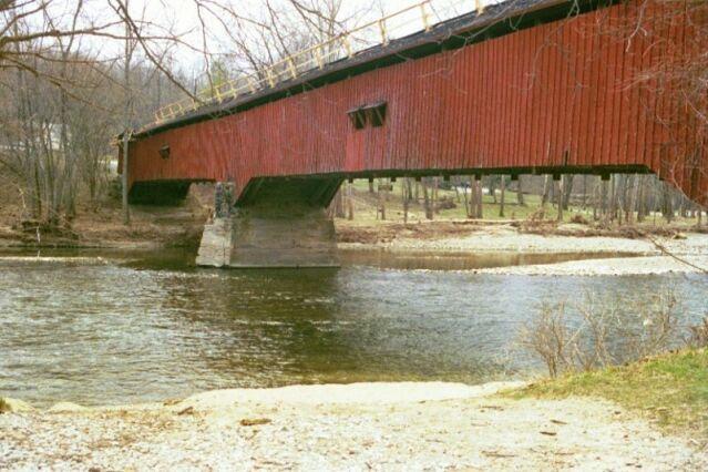
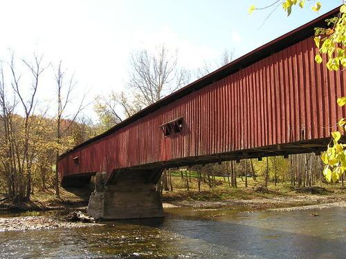
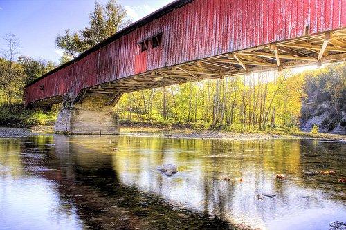
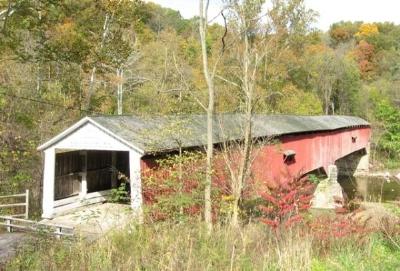
This historic covered bridge crosses Sugar Creek at the border of Shades State Park. Built in 1878, the Burr Truss bridge stretches 275 feet (84 meters) across the scenic waters. It is still open to foot traffic.
Nearby cities:
Coordinates: 39°56'45"N 87°3'33"W
- Shadyside Recreation Area 120 km
- Bell Ford Bridge 145 km
- Roann Covered Bridge 145 km
- Restored Covered Bridge & Park 204 km
- Clearbranch Methodist Baptist Church and Covered Bridge 698 km
- Abandoned Bridge Piers 795 km
- Pennsylvania Railroad Bridge (Ruins/Demolished) 898 km
- Conowingo Bridge (Former Site) 928 km
- Port Deposit Bridge remnants 934 km
- Covered Bridge Park 1645 km
- Pine Hills Nature Preserve 1.2 km
- Shades State Park 1.6 km
- Lake Holiday, Indiana 8.4 km
- Sugar Mill Lake Campground 9 km
- Turkey Run State Park and Rocky Hollow Falls Canyon Nature Preserve 14 km
- Montgomery County, Indiana 18 km
- Nucor Steel Indiana 20 km
- Hillsboro, Indiana 20 km
- Parke County, Indiana 23 km
- Fountain County, Indiana 30 km