Konaseema
India /
Andhra Pradesh /
Amalapuram /
World
/ India
/ Andhra Pradesh
/ Amalapuram
World / India / Andhra Pradesh / East Godavari
island, region
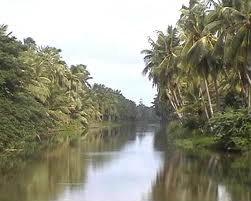
Konaseema (Telugu: కోనసీమ) is a delta located in the East Godavari district of Andhra Pradesh, India. This delta is surrounded on all sides by waters (of Godavari and the Bay of Bengal). Konaseema is very near to the,District head quarters Kakinada.
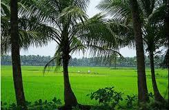
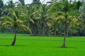
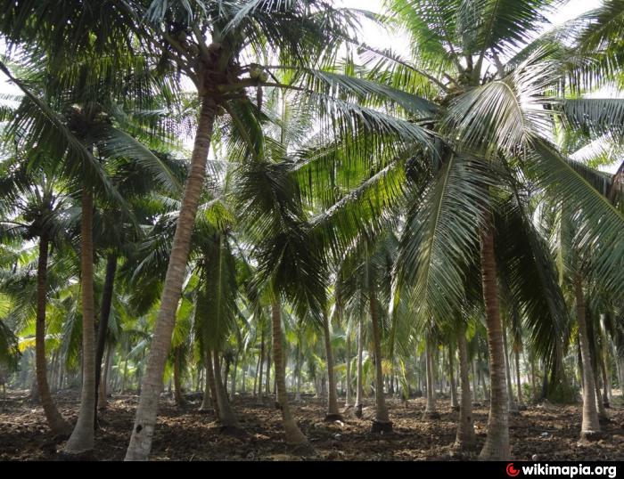
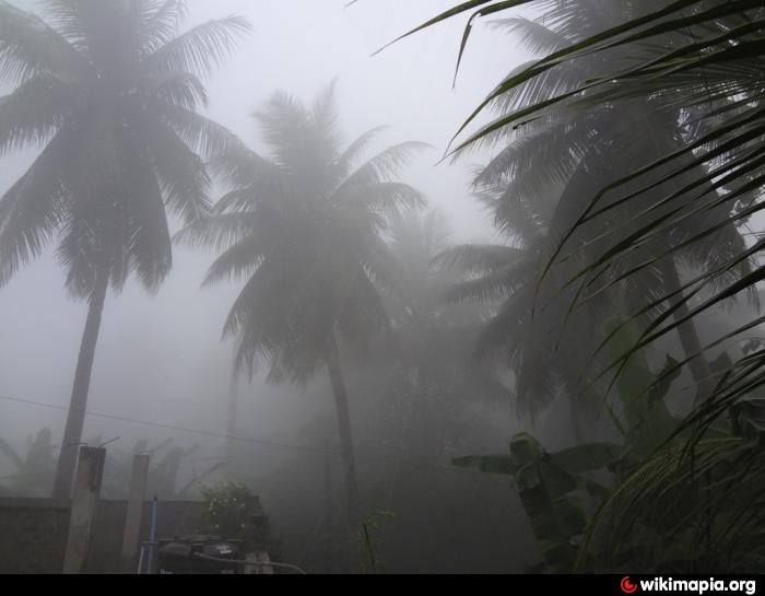
Konaseema is famous for its scenic greenery and vedic scholars. The origin of the name may be from Telugu word "Kona" meaning corner which resembles its shape. The northern side is bounded by Gautami Godavari and southern side is bounded by Vasista Godavari. It is one of most fertile lands present in Coromandel Coast. The entire region is rich in Coconut trees, Mango groves,Cashew and paddy fields.
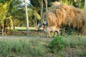
Until the 1996 cyclone which hit the area badly, the delta is also renowned for its coconut production. Even now, Konaseema is known after its coconut production and hence goes the phrase Konaseema Kobbaraaku which signifies the prominence of Konaseema in coconut production. One of the most significant components of Konaseema culture is the food; a unique part of the cuisine is its reliance on abundant local produce and sea food. There are delicacies made using Plantain flowers.
The inhabitants of Konaseema adopted a highly sustainable life-style. For example, every part of a coconut tree is used: from roots to the leaves and everything in between. This could probably be explained by the geographic isolation from the mainland. Before the construction of critical bridge infrastructure connecting to the mainland, water-based transportation was the only option. This relative isolation led to Konaseema people becoming extremely efficient at resource usage.
One has to witness a particular religious festival during "Kaartika Maasam", when women wake up before dawn, pray at a temple and light small lamps made of cotton dipped in cow ghee placed in a plantain stem and left floating in the canals. It has to be seen and cannot be described when you see floating lights, hundreds of them, lighting up a canal. All of this activity is completely natural and blends into the environment(bio-degradable)..
Konaseema is famous for its scenic greenery and vedic scholars. The origin of the name may be from Telugu word "Kona" meaning corner which resembles its shape. The northern side is bounded by Gautami Godavari and southern side is bounded by Vasista Godavari. It is one of most fertile lands present in Coromandel Coast. The entire region is rich in Coconut trees, Mango groves,Cashew and paddy fields.
Until the 1996 cyclone which hit the area badly, the delta is also renowned for its coconut production. Even now, Konaseema is known after its coconut production and hence goes the phrase Konaseema Kobbaraaku which signifies the prominence of Konaseema in coconut production. One of the most significant components of Konaseema culture is the food; a unique part of the cuisine is its reliance on abundant local produce and sea food. There are delicacies made using Plantain flowers.
The inhabitants of Konaseema adopted a highly sustainable life-style. For example, every part of a coconut tree is used: from roots to the leaves and everything in between. This could probably be explained by the geographic isolation from the mainland. Before the construction of critical bridge infrastructure connecting to the mainland, water-based transportation was the only option. This relative isolation led to Konaseema people becoming extremely efficient at resource usage.
One has to witness a particular religious festival during "Kaartika Maasam", when women wake up before dawn, pray at a temple and light small lamps made of cotton dipped in cow ghee placed in a plantain stem and left floating in the canals. It has to be seen and cannot be described when you see floating lights, hundreds of them, lighting up a canal. All of this activity is completely natural and blends into the environment(bio-degradable)..
Wikipedia article: http://en.wikipedia.org/wiki/Konaseema
Nearby cities:
Coordinates: 16°37'47"N 82°1'55"E
- Kanakaya Lanka 22 km
- Iland Of Greater RAZOLE 28 km
- Nagaram Island 35 km
- Chinna Gollapalem Island 65 km
- Island 149 km
- Island 300 km
- Sriharikota 371 km
- Venadu island 387 km
- Irukkam Island (Village) 395 km
- Vedanthangal Bird Sanctuary 511 km
- PRAKASAM VARI PALEM 0.3 km
- NEMANI SAIBABU 1 km
- DOMMETI VARI PALEM, MAGAM 1.4 km
- A.Vemavaram Cheruvu 2.8 km
- Ainavilli Mandal 3.4 km
- Manchinella Cherrvu 3.5 km
- Chakali Cheruvu 3.6 km
- Balayogi stadium 4.2 km
- KIMS 4.3 km
- Uppalaguptam Mandal 14 km
Comments