Santa Cruz Breakwater Lighthouse
USA /
California /
Live Oak /
Atlantic Avenue
World
/ USA
/ California
/ Live Oak
World / United States / California
lighthouse, breakwater, foghorn
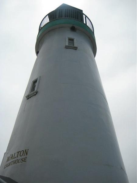
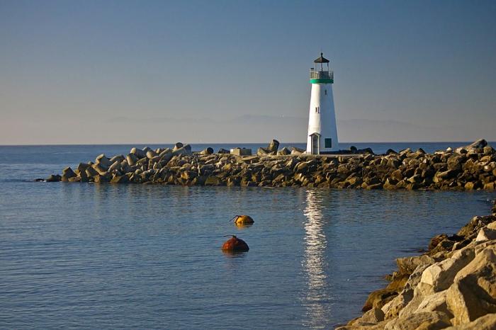
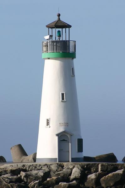
the Santa Cruz Harbor is a haven for fishing craft and vessels. A harbor light, located at the west jetty, has marked its entrance for 40 years. The original light was a box light structure which served from 1964 – 1996. It was replaced by a cylinder nicknamed “the water heater” which was used from 1996 – 1999. From 1999 until May 2002, a simple pipe structure held the light which marked the way.
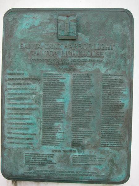
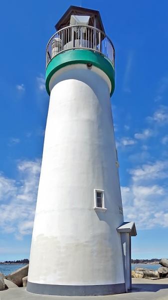
In 1998, the Santa Cruz community proposed replacing the unsightly harbor light with a lighthouse of classic design, adding a little more character to a community renowned for its characters.
The Walton lighthouse was built in 2001. On June 9, 2002, the new harbor lighthouse was dedicated, and the signal, a green light flashing every four seconds at a focal plane of 36 feet, was activated. It is named the Walton Lighthouse because Charles Walton, a local businessman, contributed a significant part of the cost in memory of his late brother Derek Walton, who was a merchant seaman.
www.nightbeacons.net/ca/walton.php
www.lighthousefriends.com/light.asp?ID=836
Wikipedia article: http://en.wikipedia.org/wiki/Santa_Cruz_Breakwater_Light
Nearby cities:
Coordinates: 36°57'38"N 122°0'7"W
- Santa Cruz (Gull Island) Aid to Navigation 389 km
- Lantern Point 577 km
- Heceta Head Lighthouse, Devils Elbow State Park 819 km
- Beacon Hill 1320 km
- Merry Island 1401 km
- Lake Minatare State Recreation Area and Historic Lake Minatare Lighthouse 1679 km
- Playa de la Isla de la Piedra 2140 km
- Smoky Point Lighthouse 3474 km
- USCG Molokai Light 3797 km
- USCG La’au Point 3833 km
- Twin Lakes State Beach 0.9 km
- Seabright 1.6 km
- Midtown 1.7 km
- Arana Gulch 1.9 km
- Lower Ocean 2 km
- Villa de Branciforte 2.6 km
- The Circles 3.2 km
- Mission Hill 3.3 km
- Pogonip Open Space 5.5 km
- Monterey Bay 20 km