Beacon Hill
| mountain, lighthouse, hilltop
USA /
New Mexico /
Lordsburg /
World
/ USA
/ New Mexico
/ Lordsburg
World / United States / New Mexico
mountain, hill, lighthouse, hilltop
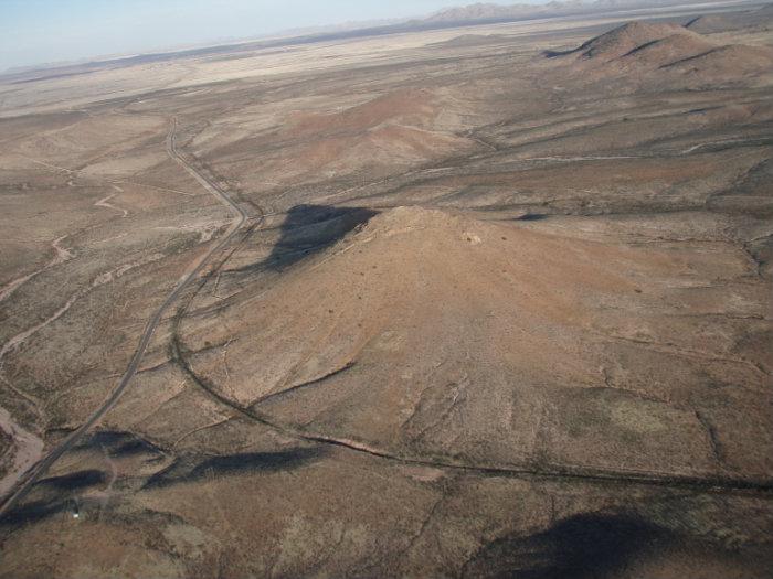
The site of an airway beacon light designating the air route between San Diego CA and El Paso TX as part of the government's intermediate field system.
References:
www.navfltsm.addr.com/howitbegan.htm
www.airfields-freeman.com/NM/Airfields_NM_SW.htm
maps of airways:
www.atchistory.org/History/Maps/Dept_of_Commerce_Aerona...
www.oldbeacon.com/beacon/maps/maps.htm
beacon information:
www.ngs.noaa.gov/cgi-bin/ds_mark.prl?PidBox=CF0310
References:
www.navfltsm.addr.com/howitbegan.htm
www.airfields-freeman.com/NM/Airfields_NM_SW.htm
maps of airways:
www.atchistory.org/History/Maps/Dept_of_Commerce_Aerona...
www.oldbeacon.com/beacon/maps/maps.htm
beacon information:
www.ngs.noaa.gov/cgi-bin/ds_mark.prl?PidBox=CF0310
Nearby cities:
Coordinates: 31°55'53"N 108°56'59"W
- Chiricahua Mountains 47 km
- Big Hatchet Mountains 55 km
- Cedar Mountain Range 65 km
- Alamo Hueco Mountains 71 km
- Sierra Alto 85 km
- El Medio 86 km
- volcanic field 106 km
- Sierra Boca Grande 109 km
- Santa Rita Mountains 192 km
- Sierra del Sarnoso 848 km
- Hidalgo County, New Mexico 32 km
- Playas Lake bed 35 km
- Animas Valley 38 km
- Playas 39 km
- Hidalgo copper smelter site 44 km
- Whitmire Canyon Wilderness Study Area 44 km
- Cowboy Rim 48 km
- Apache Hills 65 km
- Pit Tank Ridge 69 km
- Alamo Hueco Mountains 82 km