Hazel-Atlas Mine
USA /
California /
Clayton /
World
/ USA
/ California
/ Clayton
World / United States / California
mine
Add category


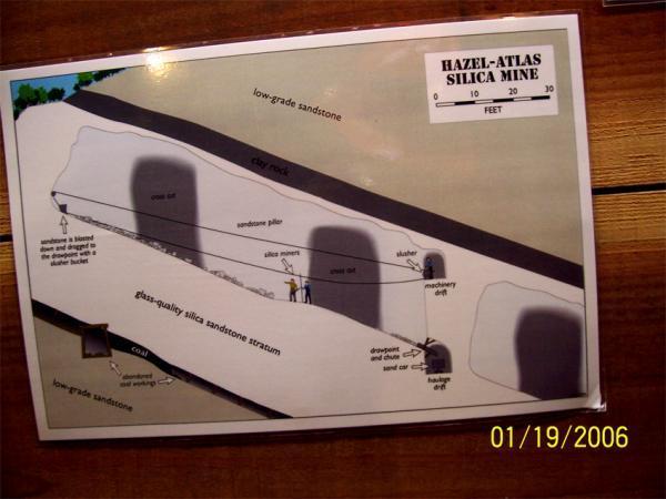

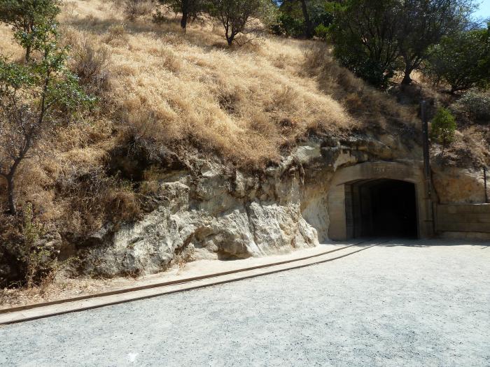
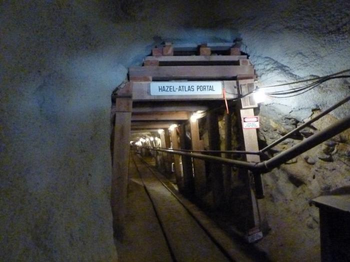
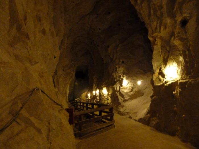
From the mid-1920s to the mid-1940s, the Hazel-Atlas Mine produced silica sand to make jars, bottles, and other glass items. Tour participants take a 400-foot walk back into the mine to see mine workings, the office of the shifter (mine boss), ore chutes, and ancient geological features.
Nearby cities:
Coordinates: 37°57'14"N 121°51'48"W
- Zion Peak Rock Quarry 10 km
- Unimin mine Altamonte Springs location 19 km
- Quarry 31 km
- SYAR Industries 51 km
- Mining Area 57 km
- Lehigh Southwest Cement - Permanente Plant 73 km
- Almaden Quicksilver County Park 82 km
- Quarry - Ione Minerals 90 km
- Dredge tailings 90 km
- A. R. Wilson Quarry 118 km
- Black Diamond Mines Regional Preserve 1.2 km
- Los Medanos Hills/Pittsburg Hills 1.9 km
- Mount Diablo 9 km
- Mount Diablo State Park 10 km
- Curry Canyon Ranch 11 km
- Lime Ridge Open Space 11 km
- Concord Naval Weapons Station 11 km
- Ygnacio Valley 15 km
- Alamo, California 18 km
- Western Delta 22 km