Hemlock Street (Christmas with the Kranks) (Downey, California)
USA /
California /
Downey /
Downey, California
World
/ USA
/ California
/ Downey
World / United States / California
historical layer / disappeared object
Add category
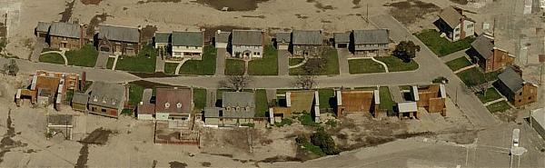
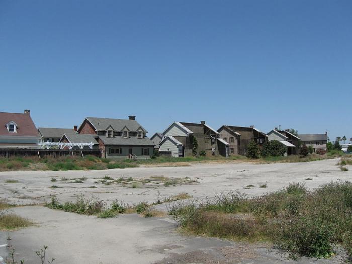

The street built for Christmas with the Kranks (2004)
Nearby cities:
Coordinates: 33°55'20"N 118°7'38"W
- site of North American- Rockwell Downey plant and Vultree Aircraft. 0.9 km
- Simons Brick Company Plant Number 3 (1905-1953) 8.1 km
- Aircraft Manufacturing Plant 10 km
- Cheli Air Force Station (site) 10 km
- Lions Drag Strip (site) 14 km
- Industrial development area, 1920s 16 km
- McDonnell Douglas Aircraft / Harvey Aluminum Plant (former site) 18 km
- NAB Terminal Island (site) 23 km
- Old Hughes Aircraft Plant and Runway (Westchester area now called Playa Vista) 28 km
- Lopez Ranch 29 km
- Kaiser Permanente Downy Medical Center 0.4 km
- Downey Landing Shopping Mall 0.5 km
- The Coca-Cola Company - Downey Bottling Plant 1.2 km
- Saint John Bosco high school 1.8 km
- Downey High School 1.9 km
- Warren High School 2 km
- Rancho Los Amigos National Rehabilitation Center 2.9 km
- Rancho Los Amigos National Rehabilitation Center, South Campus (Hollydale Asylum, Downy asylum) 3.2 km
- Los Amigos Golf Course 3.5 km
- UP Patata Industrial Lead 3.5 km
Kaiser Permanente Downy Medical Center
Downey Landing Shopping Mall
The Coca-Cola Company - Downey Bottling Plant
Saint John Bosco high school
Downey High School
Warren High School
Rancho Los Amigos National Rehabilitation Center
Rancho Los Amigos National Rehabilitation Center, South Campus (Hollydale Asylum, Downy asylum)
Los Amigos Golf Course
UP Patata Industrial Lead