Battle of Tarawa (Betio)
Kiribati /
Tarawa South /
Bairiki /
Betio
World
/ Kiribati
/ Tarawa South
/ Bairiki
World
Second World War 1939-1945, military, battlefield, historical layer / disappeared object


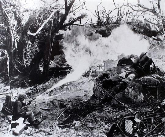


From November 20th to November 23rd, 1943 the Island of Tarawa/Betio was the site of a pitched and violent struggle between the United States Marine Corps, US Navy and Imperial Japanese Marine and Army forces. When the last shots were fired and the island was declared secure at 04:00hrs on November 23rd, some 4,317 Japanese and Korean soldiers and laborers were dead, and 990 US Marines and 687 US Navy personnel were killed. A Further 2,296 US troops and sailors were wounded.
Wikipedia article: http://en.wikipedia.org/wiki/Battle_of_Tarawa
Nearby cities:
Coordinates: 1°21'20"N 172°55'39"E
- Wake Island Atoll 2116 km
- Chuuk International Airport (PTKK) 2437 km
- Kobler Field 3362 km
- Former airfield West Field 3366 km
- Former USAAF North Field Airbase 3367 km
- Northwest Field (site) 3381 km
- Battle of Iwo Jima 4285 km
- Iwo To / Iwo Jima 4287 km
- Wreck of the HIJMS Shinano (信濃) 5150 km
- The Last Gun Line 5254 km
- Tarawa Atoll 18 km
- Maiana Atoll 47 km
- Abaiang 53 km
- Abaiang Atoll 54 km
- Marakei Atoll 83 km
- Kuria Islands 136 km
- Buariki 139 km
- Tabaiang-Tabo 145 km
- Abemama Atoll 148 km
- Aranuka Atoll 152 km