Dante's View
USA /
California /
Furnace Creek /
World
/ USA
/ California
/ Furnace Creek
World / United States / California
mountain, movie / film / TV location

Elevation 5,475 feet (1669 m) above sea level. 5,755 feet above Badwater Spring.
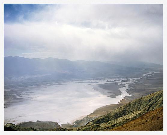
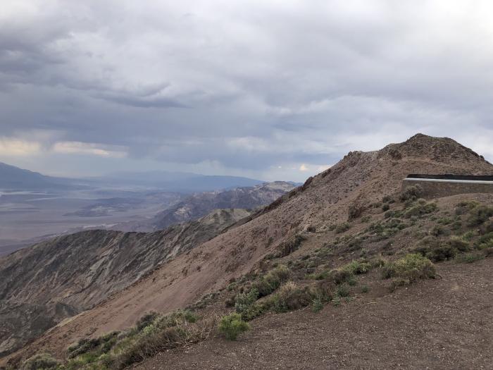
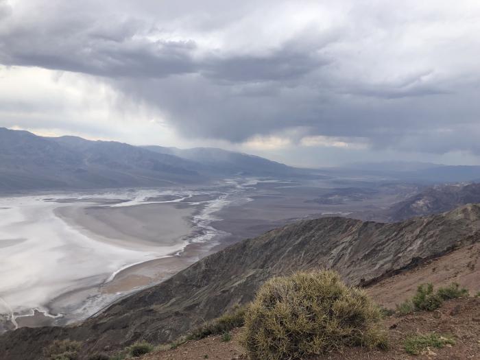
This ridge line in the Black Mountains (a spur of the Amargosa Range) separates Death Valley on the west from Greenwater Valley to the east. From here one can see the lowest point in the United States almost directly below.
Photo by Douglas Dolde looking northwest across Badwater Basin. Badwater Spring is near the bottom of the picture. The lowest point in the western hemisphere is further out, near the opposite shore of the lake.
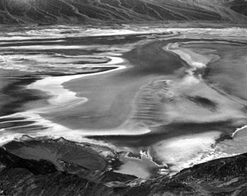
Black and white photo by Edward Weston shows how it looked in 1938.
vide:
en.wikipedia.org/wiki/Black_Mountains_%28California%29
peakbagger.com/peak.aspx?pid=93638
www.topoquest.com/map.php?lat=36.22050&lon=-116.72671&d...
Filming location of Star Wars A New Hope where the city of Mos Eisley is viewed from on top.
Death Valley National Park
This ridge line in the Black Mountains (a spur of the Amargosa Range) separates Death Valley on the west from Greenwater Valley to the east. From here one can see the lowest point in the United States almost directly below.
Photo by Douglas Dolde looking northwest across Badwater Basin. Badwater Spring is near the bottom of the picture. The lowest point in the western hemisphere is further out, near the opposite shore of the lake.
Black and white photo by Edward Weston shows how it looked in 1938.
vide:
en.wikipedia.org/wiki/Black_Mountains_%28California%29
peakbagger.com/peak.aspx?pid=93638
www.topoquest.com/map.php?lat=36.22050&lon=-116.72671&d...
Filming location of Star Wars A New Hope where the city of Mos Eisley is viewed from on top.
Death Valley National Park
Wikipedia article: http://en.wikipedia.org/wiki/Dante's_View
Nearby cities:
Coordinates: 36°13'14"N 116°43'35"W
- Panamint Range 46 km
- Owlshead Mountains 56 km
- Tucki Mountain 59 km
- Slate Range 60 km
- Quail Mountains 67 km
- Spring Mountains 73 km
- Kingston Range 77 km
- Clark Mountain Range 113 km
- Old Dad Mountains 137 km
- Ship Mountains Range 217 km
- Badwater Basin 8.5 km
- Alluvial Fan 11 km
- Devil's Golf Course 13 km
- Deb Analog 17 km
- Death Valley National Park 29 km
- Panamint Range 37 km
- Supersonic Low Level test area 53 km
- Panamint Valley 58 km
- Cottonwood Mountains 84 km
- Naval Air Weapons Station China Lake, North Range 90 km
Comments