Mường Khương District
Vietnam /
Mien Nui Va Trung Du /
Lao Cai /
World
/ Vietnam
/ Mien Nui Va Trung Du
/ Lao Cai
World / Vietnam / Đông Bắc / Lào Cai / Mường Khương
district, draw only border


of Lao Cai Province, SR Vietnam.
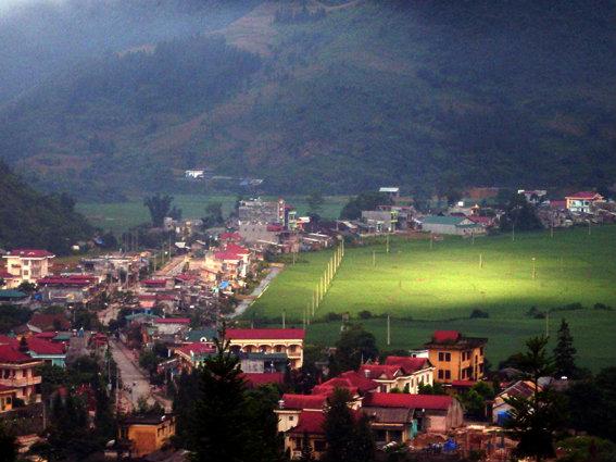
Muong Khuong (Vietnamese: Mường Khương) is a district (huyện) of Lao Cai Province in the Northeastern region of Vietnam.
As of 2003 the district had a population of 48,242. The district covers an area of 552 km². The district capital lies at Muong Khuong.
Muong Khuong (Vietnamese: Mường Khương) is a district (huyện) of Lao Cai Province in the Northeastern region of Vietnam.
As of 2003 the district had a population of 48,242. The district covers an area of 552 km². The district capital lies at Muong Khuong.
Wikipedia article: http://en.wikipedia.org/wiki/Muong_Khuong_District
Nearby cities:
Coordinates: 22°40'57"N 104°8'19"E
- District Upper Siang (AP) 1232 km
- Rangamati District 1246 km
- Khagrachari District 1276 km
- Maulvibazar District 1297 km
- Sylhet District 1304 km
- Chattogram District Area 1305 km
- Habigonj District 1343 km
- Noakhali District 1365 km
- Bhola District 1420 km
- Lhuentse Dzongkhag 1471 km
- Ban Lien commune 32 km
- Then Phang Commune 37 km
- Nam Dan Commune 38 km
- Quang Nguyen Commune 45 km
- Ban May Commune 47 km
- Ho Thau Commune 51 km
- Nam Khoa Commune 56 km
- Nam Ty Commune 65 km
- Tung San Commune 66 km
- Lao Chai Commune 67 km