Wupatki Pueblo
USA /
Arizona /
Cameron /
World
/ USA
/ Arizona
/ Cameron
World / United States / Arizona
monument, pueblo, historic ruins


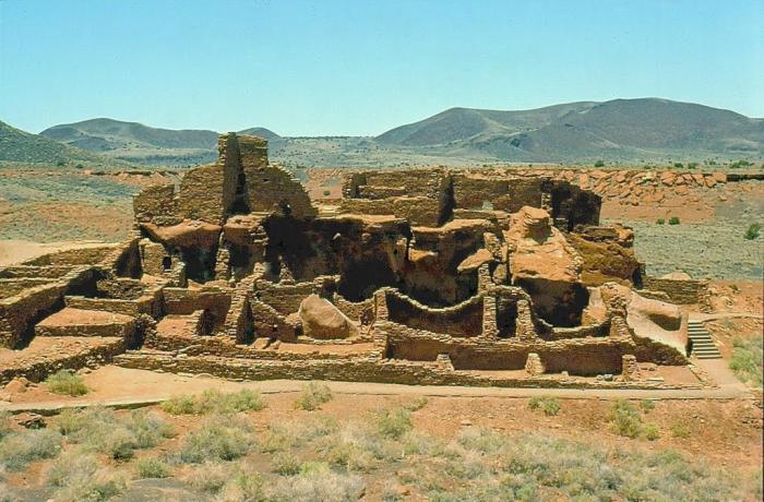
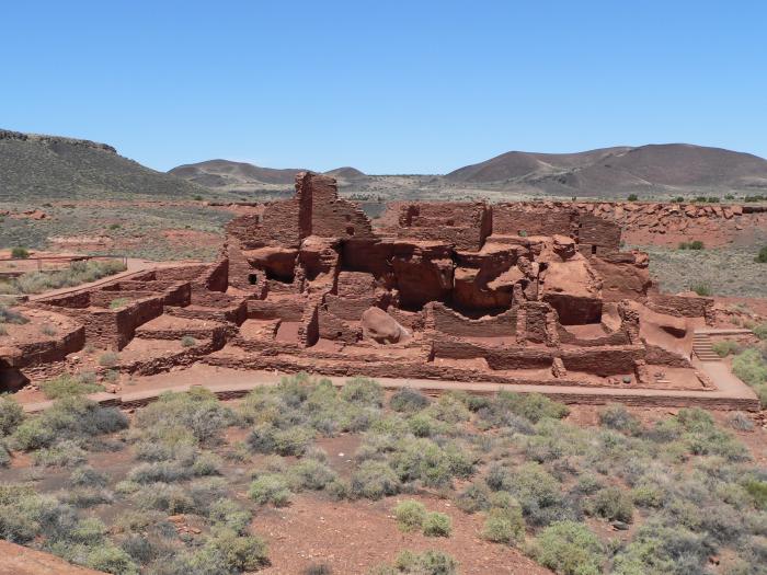
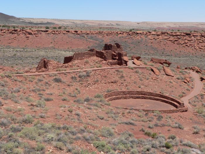
"For its time and place, there was no other pueblo like Wupatki. Less than 800 years ago, it was the tallest, largest, and perhaps the richest and most influential pueblo around. It was home to 85-100 people, and several thousand more lived within a day’s walk. And it was built in one of the lowest, warmest, and driest places on the Colorado Plateau. What compelled people to build here?"
www.nps.gov/wupa/
The Wupatki Ruins is part of a system of Ruins preserved in the Wupatki National Monument.
www.nps.gov/wupa/
The Wupatki Ruins is part of a system of Ruins preserved in the Wupatki National Monument.
Wikipedia article: http://en.wikipedia.org/wiki/Wupatki_National_Monument
Nearby cities:
Coordinates: 35°31'16"N 111°22'21"W
- Wupatki National Monument 20 km
- The Grand Canyon (central section) 129 km
- Petrified Forest National Park 133 km
- The Grand Canyon (north-east section) 159 km
- Tonto National Forest 177 km
- Chaco Canyon - Chaco Culture National Historical Park 304 km
- Ironwood Forest National Monument 320 km
- Bandelier National Monument 446 km
- Colorado National Monument 463 km
- Dinosaur National Monument 608 km
- Doney Cliffs 4.7 km
- Strawberry Crater Wilderness Area 12 km
- Crater 160 24 km
- S P (Shit Pot) Crater 24 km
- Gray Mountain 27 km
- Hopi Trail Canyon 47 km
- Peterson Flat 52 km
- Hell Hole Bend 55 km
- Little Colorado River Gorge 65 km
- Grand Canyon National Park 153 km