Tinduf
| city, capital city of state/province/region
Morocco /
Guelmim /
World
/ Morocco
/ Guelmim
/ Guelmim
, 259 km from center (كلميم)
World / Algeria / Tindouf
city, capital city of state/province/region
Erroneous state attribution by Google!!
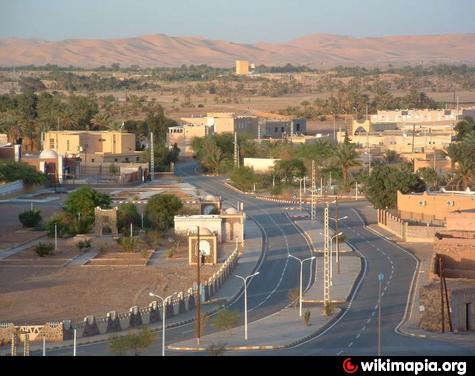
Tinduf is the main town of the Tinduf Province, Algeria. Since Algerian independence in 1962, the town has been purposely built up. The region is of strategic significance, and it houses Algerian military bases.
Since 1975, it also contains several Sahrawi refugee camps operated by the Polisario Front a guerilla group seeking the independence of Western Sahara. Because of the strict censorship of the internet in the camps you can find almost no entries posted by users of this area. To leave the camps or a voluntary return to the western Moroccan controlled areas will not be tolerated by the Polisario.
The city is served by the Tinduf Airport, northwest of the town, with regular flights to Algiers as well as to other domestic destinations.
The town of Tindouf was built near an isolated Saharan oasis in 1852 by members of the Tajakant tribe, but sacked and destroyed by Reguibat, a Sahrawi tribe in 1895, and the Tajkant tribe were kicked out of the region. It was was an important Reguibat encampment until French troops occupied the area in 1934.
P.D Any change without any valid reason of the title (and description) of this place will be considered VANDALISM, so if you do it, you can be banned or limited, and remember wikimapia is not a political forum.
But your neutral(!) report and pictures about the substantive, present-day situation please add at this position! And add your political representations only in the comment!
Wikipedia article: http://en.wikipedia.org/wiki/Tindouf
Nearby cities:
Coordinates: 27°39'25"N 8°7'59"W
- Sidi Ifni 281 km
- Ait Melloul 331 km
- Agadir 344 km
- Zagora 376 km
- Ouarzazate 384 km
- Marrakech 450 km
- Tinghir 498 km
- Errachidia 595 km
- Béchar 719 km
- Adrar 769 km
- Uad Sobti 11 km
- Wad Tatrat 12 km
- Ausserd Refugee Camp 25 km
- Sebkha of Tindouf 45 km
- Algerian borderwall 48 km
- Wad el Ma 65 km
- Sebkha of Tiandjouk 86 km
- Kereb en Neggar 101 km
- Hamada el Barka 113 km
- Hamada ed Douakel 119 km
Comments