Historical Marker Cairn (Ladysmith)
Canada /
British Columbia /
Ladysmith
World
/ Canada
/ British Columbia
/ Ladysmith
World / Canada / British Columbia / Cowichan Valley
historic landmark
Add category
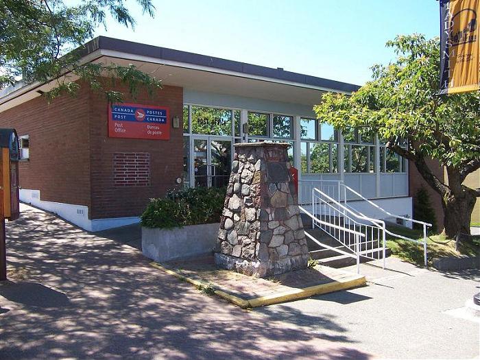
This is situated in front of the post office and carries a brass plaque that reads:
---------------------------------------
LADYSMITH on the 49th parallel
Originally known as Oyster Bay. Settlement began in 1897. With the opening of nearby collieries townsite began to develop as a port of shipment. The new town was named Ladysmith to commemorate the relief of Ladysmith in the Boer War, March 1900. Incorporated as a city June 3, 1904, status was changed to village January 1, 1958.
---------------------------------------
---------------------------------------
LADYSMITH on the 49th parallel
Originally known as Oyster Bay. Settlement began in 1897. With the opening of nearby collieries townsite began to develop as a port of shipment. The new town was named Ladysmith to commemorate the relief of Ladysmith in the Boer War, March 1900. Incorporated as a city June 3, 1904, status was changed to village January 1, 1958.
---------------------------------------
Nearby cities:
Coordinates: 48°59'38"N 123°49'7"W
- Fort Casey 122 km
- Joint Base Lewis-McChord 218 km
- JBLM McChord Field (TCM/KTCM) 227 km
- Fort Stevens State Park 307 km
- Rock Ovens Regional Park 316 km
- The Myra Canyon - KVR Historic Trestles 336 km
- Fort William Henry Harrison 910 km
- Bear Butte State Park 1627 km
- Spade Ranch 1814 km
- Kakagon Sloughs 2463 km
- Regans 3.3 km
- Woodley Range Ecological Reserve 3.5 km
- Stocking Lake 3.7 km
- Yellow Point 3.7 km
- Kulleet Bay 4.3 km
- Michael Lake 5.2 km
- Stocking Creek Park 5.3 km
- Holland Lake 6.2 km
- Yellow Point Lodge 7.2 km
- Cedar 7.6 km