Marony Dam
USA /
Montana /
Carter /
Marony Dam Road, 6900
World
/ USA
/ Montana
/ Carter
World / United States / Montana
dam
Add category

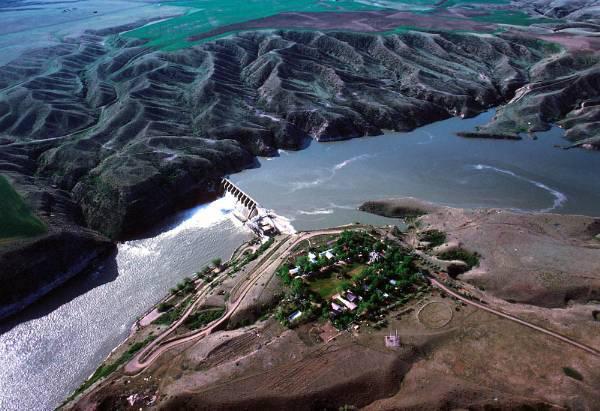
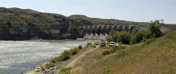


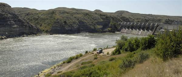
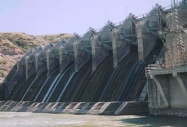
Marony Dam, completed in 1930, is one of two hydroelectric dams in the region that was not constructed atop a falls. Morony Dam is a hydroelectric gravity dam located on the Missouri River in Cascade County, Montana. The dam is 883 feet (269 m) long and 94 feet (29 m) high, and generates 48 megawatts (MW) of power.
Wikipedia article: http://en.wikipedia.org/wiki/Morony_Dam
Nearby cities:
Coordinates: 47°34'52"N 111°3'36"W
- Fort Peck Dam 347 km
- Qu'Appelle Dam 506 km
- Gardiner Dam 510 km
- Homstake Mining Company Tailings Impoundment 671 km
- Garrison Dam 723 km
- Oahe Dam 892 km
- Fort Randall Dam 1097 km
- Virginia Smith Dam 1132 km
- Coon Rapids Dam Regional Park (Anoka County) 1385 km
- Lock and Dam No. 12 1724 km
- Highwood, Montana 22 km
- Carter, Montana 25 km
- Juliet Flight 32 km
- Highland Mountains 40 km
- Alpha Flight 41 km
- Square Butte 63 km
- Bravo Flight 66 km
- Charlie Flight 90 km
- Delta Flight 98 km
- Mike Flight 118 km