William T. Piper Memorial Airport (KLHV) (Lock Haven, Pennsylvania)
USA /
Pennsylvania /
Dunnstown /
Lock Haven, Pennsylvania /
Proctor St., 353
World
/ USA
/ Pennsylvania
/ Dunnstown
World / United States / Pennsylvania
airport
Add category
Airport Identifier: LHV
Elevation: 556 ft / 169.47 m (Surveyed)
Land: 112 acres
From nearest city: 2 nautical miles E of Lock Haven, PA
Location: Clinton County, PA
Magnetic Variation: 11W (2005)
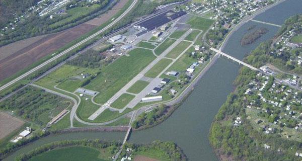
William T. Piper Memorial Airport (IATA: LHV, ICAO: KLHV, FAA LID: LHV) is a public general aviation airport located two miles (3 km) east of the central business district of Lock Haven, a city in Clinton County, Pennsylvania, USA. Named for William T. Piper, the airport is located at the foot of the Bald Eagle Mountain ridge, between the West Branch Susquehanna River and its tributary, Bald Eagle Creek. It covers 112 acres (45 ha), has two runways and is operated by the City of Lock Haven.
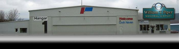
The airport is home to AvSport of Lock Haven, a general aviation flight school specializing in Sport Pilot training in Light Sport Aircraft.
353 Proctor St., Lock Haven, PA 17745 Ph. (570) 748-5123
Fx. (570) 893-4218
www.piperairport.com/
www.lockhavencity.org/cgi-bin/index.pl?lnk=dp&bdy=dept_...
www.airport-data.com/airport/LHV
www.globalair.com/airport/airport.aspx?aptcode=KLHV
Elevation: 556 ft / 169.47 m (Surveyed)
Land: 112 acres
From nearest city: 2 nautical miles E of Lock Haven, PA
Location: Clinton County, PA
Magnetic Variation: 11W (2005)
William T. Piper Memorial Airport (IATA: LHV, ICAO: KLHV, FAA LID: LHV) is a public general aviation airport located two miles (3 km) east of the central business district of Lock Haven, a city in Clinton County, Pennsylvania, USA. Named for William T. Piper, the airport is located at the foot of the Bald Eagle Mountain ridge, between the West Branch Susquehanna River and its tributary, Bald Eagle Creek. It covers 112 acres (45 ha), has two runways and is operated by the City of Lock Haven.
The airport is home to AvSport of Lock Haven, a general aviation flight school specializing in Sport Pilot training in Light Sport Aircraft.
353 Proctor St., Lock Haven, PA 17745 Ph. (570) 748-5123
Fx. (570) 893-4218
www.piperairport.com/
www.lockhavencity.org/cgi-bin/index.pl?lnk=dp&bdy=dept_...
www.airport-data.com/airport/LHV
www.globalair.com/airport/airport.aspx?aptcode=KLHV
Wikipedia article: http://en.wikipedia.org/wiki/William_T._Piper_Memorial_Airport
Nearby cities:
Coordinates: 41°8'10"N 77°25'24"W
- Greater Rochester International Airport (KROC) 223 km
- Syracuse Hancock International Airport (SYR/KSYR) 245 km
- Stewart International Airport - SWF/KSWF 278 km
- Old Oneida County Airport 281 km
- Griffiss International Airport - RME/KRME 287 km
- CFD Mountainview 327 km
- CFB Trenton 335 km
- Albany International Airport (KALB/ALB) 349 km
- Wheeler-Sack Army Airfield (KGTB/GTB) 356 km
- Plattsburgh International Airport (PBG/KPBG) 508 km
- Clinton County, Pennsylvania 19 km
- Bald Eagle State Park 23 km
- Centre County, Pennsylvania 34 km
- Lycoming County, Pennsylvania 40 km
- Pine Creek Gorge 42 km
- Grove Township 57 km
- Rush Township 69 km
- Cameron County, Pennsylvania 72 km
- Potter County, Pennsylvania 78 km
- Clearfield County, Pennsylvania 85 km