Mount Klabat
| volcano
Indonesia /
Sulawesi Utara /
Bitung /
World
/ Indonesia
/ Sulawesi Utara
/ Bitung
World / Indonesia / Sulawesi Utara
volcano
Add category

Klabat, Minahasa, North Sulawesi
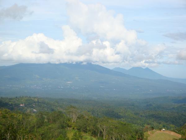
Klabat is an isolated symmetrical stratovolcano that rises to 1995 m near the eastern tip of the elongated northern arm of Sulawesi Island. The volcano lies east of the city of Manado (also spelled Menado) and is the highest in Sulawesi. Klabat has a shallow lake in its 170 x 250 m summit crater. No verified historical eruptions have occurred from this volcano, but fumarolic activity has occurred within historical time. A report of an eruption in 1683 probably was from nearby Tongkoko volcano.
www.volcano.si.edu/world/volcano.cfm?vnum=0606-12=
Wikipedia article: https://en.wikipedia.org/wiki/Mount_Klabat
Nearby cities:
Coordinates: 1°27'16"N 125°1'47"E
- Makian Island 284 km
- Leonard Kniaseff Volcano 679 km
- Sugarloaf Complex 762 km
- Malindang Mountain Range Natural Park 795 km
- Mount Balatukan 829 km
- Pocdol Mountains 1301 km
- Mount Isarog 1376 km
- Mount Mariveles 1546 km
- Mount Pinatubo 1615 km
- Babuyan Island 2046 km
- Mount Klabat
- PT.Multibredeer Adirama Indonesia.Tbk(Joune pe bekas perusahaan) 5 km
- Perumahan Giovanni Mas 5.1 km
- Griya Mutiara Laikit 5.5 km
- Agape Griya 5.5 km
- Kauditan Interchange 6.2 km
- Camping ground 6.3 km
- Airmadidi Interchange 7.5 km
- Bitung 17 km
- Minahasa Utara 19 km
Comments