Shyamnagar Upazila HQ
India /
Bangla /
Noapara /
World
/ India
/ Bangla
/ Noapara
World / India / West Bengal / South 24 Parganas
tourism, township, subdistrict, fourth-level administrative division, local government
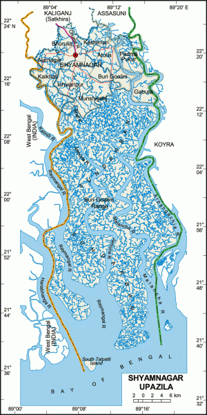
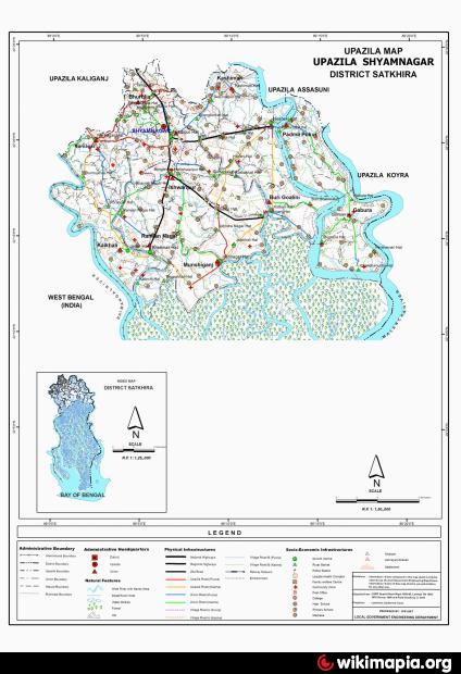
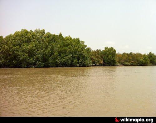
Shyamnagar Upazila (Satkhira district) with an area of 1968.24 sq km, is bounded by Kaliganj (Satkhira) and Assasuni upazilas on the north, Sundarbans and bay of Bengal on the south, Koyra and Assasuni upazilas on the east, west Bengal of India on the west. Main rivers are Raymangal, Kalindi, Kobadak, Mother Kholpetua, Arpangachia, Malancha Hariabhanga and Chuna. South Talpatti Island at the estuary of the Hariabhanga is notable.
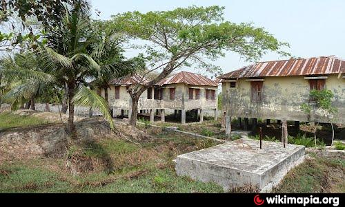
The location of Shyamnagar town is 22.3433076N 89.1034504E. Shyamnagar (Town) consists of 5 mouzas and 13 villages. The area of the town is 10.76 sq km. The town has a population of 11021; male 52.36% and female 47.64%. The density of population is 1024 per sq km. Literacy rate among the town people is 37.3%. The town has three dakbungalows and a BDR Head Quarter.
Shyamnagar thana was turned into an upazila in 1982. It consists of 13 union parishads, 127 mouzas and 216 villages.
Archaeological heritage and relics: Five domed Tenga Mosque at Banshipur (Mughal period), two big and four small domed Hammankhana at Banshipur (constructed by Raja Pratapaditya), Joseshwari Mandir (built by Raja Pratapaditya), Chanda Bhairab Mandir at Ishwaripur (a triangular temple, built during the Sena period), Govinda Dev Mandir at Gopalpur (Basanta Roy (uncle of Pratapaditya) built it in 1593), Jahajghata Durgah (Khanpur).
As of the 1991 Bangladesh census, Population 265004; male 50.46%, female 49.54%; Muslim 74.14%, Hindu 25.40%, Christian 0.06%, Buddhist 0.01% and others 0.39%; ethnic nationals: Munda (Buno) families 300.
Religious institutions: Mosque 251, temple 98, church 1 and sacred place 2, most noted of which are Banshipur Sahi Mosque (Tenga Mosque), tomb of Nurullah Khan at Nurnagar, Joseshwari Mandir and Chanda Bhairab Mandir.
Literacy and educational institutions: Average literacy 28.1%; male 38% and female 17.4%. Educational institutions: college 5, high school 28, madrasa 98, government primary school 96, non-government primary school 56, kindergarten 2, orphanage 4. Noted educational institutions: Nakipur Haricharan High School (1899), Nurnagar Ashalata High School (1955), Shyamnagar Mohsin College (1972).
Main occupations: Agriculture 32.93%, agricultural labour 25.81%, wage labourer 6.21%, forestry 2.34%, fishing 5.5%, transport 1.61%, commerce 10.11%, service 3.38% and transport 12.11%.
Land use: Total cultivable land 38552 hectares, fallow land 6257.79 hectares; single crop 23.8%, double crop 55.06% and treble crop land 21.14%.
Land control: Among the peasants, 19% are landless, 30% small, 28% marginal, 16.5% intermediate and 6.5% rich; cultivable land per head 0.13 hectare.
Fisheries, dairies, poultries Poultry 81, dairy 52, hatchery (poultry) 29.
Communication facilities- Roads: pucca 67 km, semi pucca 35 km and mud road 811 km; waterways 73 nautical mile.
Manufactories: Printing press 2, ice factory 4, saw mill 11 and lathe machine 4.
Cottage industries: Weaving 51, goldsmith 18, blacksmith 39, potteries 4, wood work 200, bamboo work 70, fishing 300, baowali 400, moual 250.
NGO activities: Operationally important NGOs are brac, caritas, asa, Sushilan, Nakshi Kantha Mohila Unnayan Sangstha, Shyamnagar Mohila Attakarmasangsthan, Setu, Bharasa.
Health centres: Upazila health complex 1, family planning centre 9.
Nearby cities:
Coordinates: 22°20'7"N 89°6'21"E
- Koyra Upzila HQ 17 km
- Kalaroa Upazila HQ 62 km
- Morrelganj upazila 76 km
- Fakirhat Upazila HQ 79 km
- Abhaynagar Upazila HQ 85 km
- Kachua Upazila HQ 86 km
- Jhikargachha Upazila HQ 88 km
- Patharghata Upazila HQ 91 km
- Bholahat Upazila HQ 307 km
- Parsa 576 km
- Dilruba Digital Studio 9 km
- JOGESHGUNJ ISLAND 11 km
- Kuslia 12 km
- Kaliganj, Satkhira 16 km
- Shithalia. 18 km
- Hingalganj 19 km
- Purba Khejure Beria 22 km
- K. D. Sahapara High School 29 km
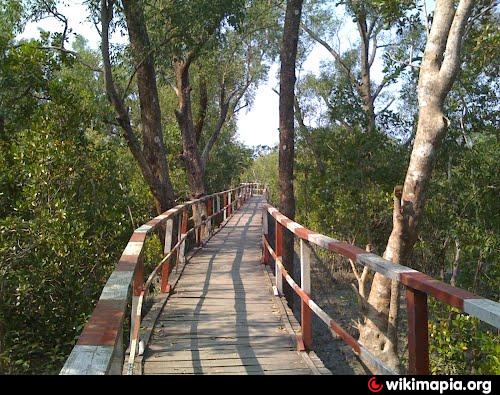
- Sundarbans 36 km
- Khulna Division 67 km