Kaparelli
| village
Greece /
Voiotia /
Kaparellion /
World
/ Greece
/ Voiotia
/ Kaparellion
, 1 km from center (Καπαρέλλιον)
World / Greece / Peloponnisos
village
Add category
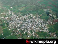
Kaparelli is a village in Boeotia, and the local headquarters of the municipality of Thebes, as established under the Program Kallikrates.
Its population is Kaparelli 1,549 residents according to the 2001 census, and is located at an altitude of 320m.
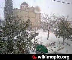
Kaparelli is patron of Saint Panteleimon. The church is Byzantine and construction dates from the period of Frankish rule (1204-1460). In 1904 work began to get the church its present form at the expense of church funds and donations piston.To church's interior is impressive with numerous chandeliers and wall paintings.
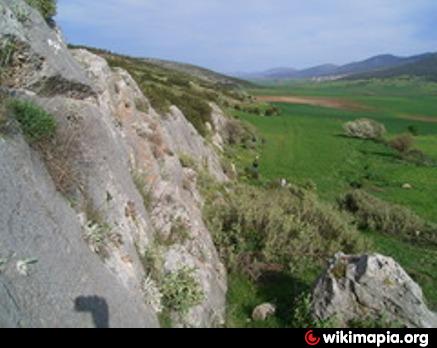
Near the village is a small river called 'Oeroi "from the name of a nymph.
In 1981 the village was rocked by a large earthquake Alkyonidon the Corinthian Gulf.
Its population is Kaparelli 1,549 residents according to the 2001 census, and is located at an altitude of 320m.
Kaparelli is patron of Saint Panteleimon. The church is Byzantine and construction dates from the period of Frankish rule (1204-1460). In 1904 work began to get the church its present form at the expense of church funds and donations piston.To church's interior is impressive with numerous chandeliers and wall paintings.
Near the village is a small river called 'Oeroi "from the name of a nymph.
In 1981 the village was rocked by a large earthquake Alkyonidon the Corinthian Gulf.
Nearby cities:
Coordinates: 38°14'8"N 23°12'59"E
- Porto Germeno 7.8 km
- Alepochori 17 km
- Goritsà District 33 km
- Mytikas 44 km
- Malakasa 49 km
- Agioi Apostoloi 58 km
- Kamari 59 km
- Anthousa 61 km
- Dràfi District 63 km
- Lykoporia 65 km
- Plataiai 5.7 km
- Mt. Kithairon 6.1 km
- interesting site 7.7 km
- Battle of Plataea (479 BC) 8 km
- NIKE Launching Area (LA) 9 km
- Karoumpalo 11 km
- Peripheral unit of Boeotia 18 km
- Pateras Mountains 20 km
- Attica 43 km
- Gulf of Corinth 63 km
Comments